 Old Cumbria Gazetteer
 |
 |
|
| Lindal Cote Iron Mines, Lindal and Marton | ||
| Lindal Cote Iron Mines | ||
| Pinder Ring Pit | ||
| civil parish:- | Lindal and Marton (formerly Lancashire) | |
| county:- | Cumbria | |
| locality type:- | iron mine | |
| locality type:- | mine | |
| coordinates:- | SD24757499 (etc) | |
| 1Km square:- | SD2474 | |
| 10Km square:- | SD27 | |
|
|
||
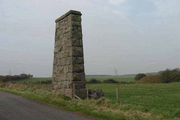 BVQ26.jpg Remains of a tramroad overbridge for the Grievson Pit (not located). (taken 11.11.2011) |
||
|
|
||
| evidence:- | old map:- OS County Series (Lan 16 10) placename:- Lindal Cote Iron Mines placename:- Pinder Ring Pit |
|
| source data:- | Maps, County Series maps of Great Britain, scales 6 and 25
inches to 1 mile, published by the Ordnance Survey, Southampton,
Hampshire, from about 1863 to 1948. "Lindal Cote Iron Mines / Pinder Ring Pit" |
|
|
|
||
 Lakes Guides menu.