 Old Cumbria Gazetteer
 |
 |
|
| Carlisle: Paternoster Row | ||
| Paternoster Row | ||
| locality:- | Carlisle | |
| civil parish:- | Carlisle (formerly Cumberland) | |
| county:- | Cumbria | |
| locality type:- | street | |
| coordinates:- | NY39825598 (etc) | |
| 1Km square:- | NY3955 | |
| 10Km square:- | NY35 | |
|
|
||
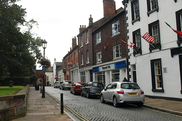 BXH88.jpg (taken 17.9.2012) 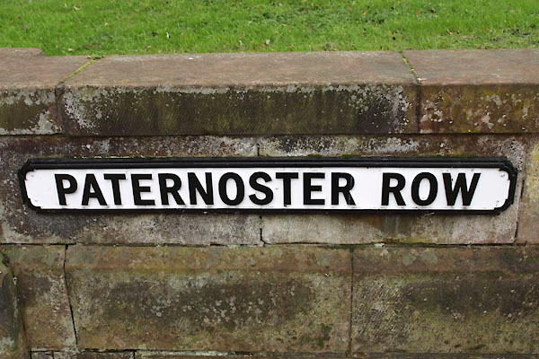 BXH89.jpg Street name, (taken 17.9.2012) |
||
|
|
||
| evidence:- | old map:- OS County Series (Cmd 23 3) placename:- Paternoster Row |
|
| source data:- | Maps, County Series maps of Great Britain, scales 6 and 25
inches to 1 mile, published by the Ordnance Survey, Southampton,
Hampshire, from about 1863 to 1948. |
|
|
|
||
| evidence:- | old map:- Donald 1774 (Cmd) placename:- Pater Noster Row |
|
| source data:- | Map, hand coloured engraving, 3x2 sheets, The County of Cumberland, scale about 1
inch to 1 mile, by Thomas Donald, engraved and published by Joseph Hodskinson, 29
Arundel Street, Strand, London, 1774.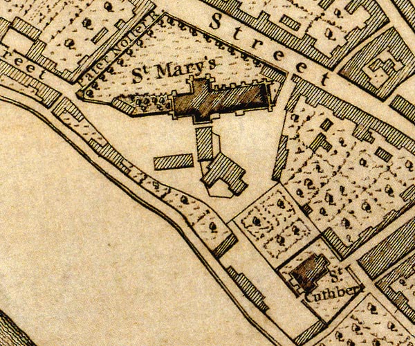 D43955Z.jpg "Pater Noster R." street item:- Carlisle Library : Map 2 Image © Carlisle Library |
|
|
|
||
| evidence:- | old painting:- item:- street lamp |
|
| source data:- | Painting, watercolour, Paternoster Row, from West Walls, Carlisle, Cumberland, by
Thomas Bushby, 1895.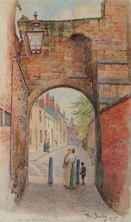 click to enlarge click to enlargePR0799.jpg View of Paternoster Row framed by a sandstone arch beneath which stands a woman holding an infant in her arms, a small boy standing beside her. inscribed at bottom left:- "Paternoster Row, Carlisle" signed &dated at bottom right:- "Thos. Bushby. 1895" item:- Tullie House Museum : 1895.47.1 Image © Tullie House Museum |
|
|
|
||
 Lakes Guides menu.