 Old Cumbria Gazetteer
 |
 |
|
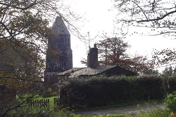
| Henry VI Monument, Muncaster | ||
| Henry VI Monument | ||
| Muncaster Tower | ||
| locality:- | Chapels | |
| civil parish:- | Muncaster (formerly Cumberland) | |
| county:- | Cumbria | |
| locality type:- | tower | |
| locality type:- | folly (?) | |
| locality type:- | monument | |
| coordinates:- | SD11089749 | |
| 1Km square:- | SD1197 | |
| 10Km square:- | SD19 | |
|
|
||
 CGU66.jpg (taken 25.10.2017) 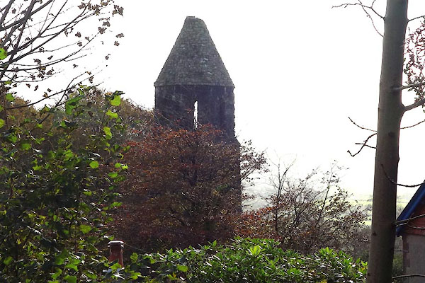 CGU67.jpg (taken 25.10.2017) |
||
|
|
||
| evidence:- | old map:- OS County Series (Cmd 82 8) |
|
| source data:- | Maps, County Series maps of Great Britain, scales 6 and 25
inches to 1 mile, published by the Ordnance Survey, Southampton,
Hampshire, from about 1863 to 1948. "Monument" marked by a cirlce |
|
|
|
||
| hearsay:- |
3 story gothic tower erected by Sir John Pennington about 1800. It is said to mark
the spot where Henry VI, flying from enemies during the War of the Roses after the
Battle of Towton, 1461, met a shepherd who took him to find safe lodging with the
then Sir John Pennington. |
|
|
|
||
 Lakes Guides menu.