 Old Cumbria Gazetteer
 |
 |
|
| Outgang, Pardshaw | ||
| Outgang | ||
| Outgang Farm | ||
| locality:- | Pardshaw | |
| civil parish:- | Dean (formerly Cumberland) | |
| county:- | Cumbria | |
| locality type:- | buildings | |
| locality type:- | inn (? ex) | |
| coordinates:- | NY09572487 (?) | |
| 1Km square:- | NY0924 | |
| 10Km square:- | NY02 | |
| SummaryText:- | have I muddled two buildings? | |
|
|
||
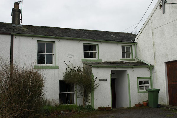 BWC19.jpg (taken 19.3.2012) 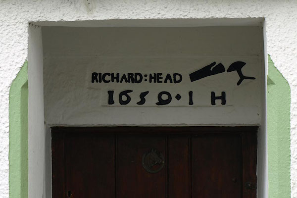 BWC21.jpg Date stone:- "RICHARD : HEAD / 1659 . I H" (taken 19.3.2012) |
||
|
|
||
| evidence:- | possibly old map:- OS County Series (Cmd 62 3) placename:- Dog and Gun |
|
| source data:- | Maps, County Series maps of Great Britain, scales 6 and 25
inches to 1 mile, published by the Ordnance Survey, Southampton,
Hampshire, from about 1863 to 1948. |
|
|
|
||
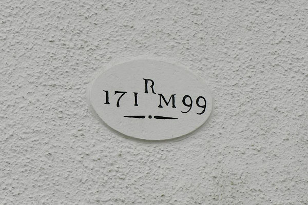 BWC20.jpg Date stone:- "R / 17 I M 99" (taken 19.3.2012) |
||
|
|
||
 Lakes Guides menu.