 Old Cumbria Gazetteer
 |
 |
|
|
| included in:- |
 road, Hawkshead to Newby Bridge road, Hawkshead to Newby Bridge |
||
| road, Far Sawrey to Newby Bridge | |||
| Far Sawrey to Newby Bridge | |||
| Newby Bridge to Far Sawrey | |||
| civil parish:- | Claife (formerly Lancashire) | ||
| civil parish:- | Satterthwaite (formerly Lancashire) | ||
| civil parish:- | Colton (formerly Lancashire) | ||
| civil parish:- | Staveley-in-Cartmel (formerly Lancashire) | ||
| county:- | Cumbria | ||
| locality type:- | route | ||
| 10Km square:- | SD39 | ||
| 10Km square:- | SD38 | ||
|
|
|||
| evidence:- | old map:- Clarke 1787 map (Windermere S) |
||
| source data:- | Map, A Map of the Southern Part of the Lake Winandermere and its
Environs, scale about 6.5 ins to 1 mile, by James Clarke,
engraved by Samuel John Neele, 352 Strand, published by James
Clarke, Penrith, Cumberland and in London etc, 1787.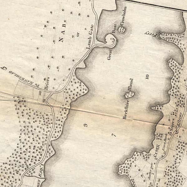 CLBSD39X.jpg 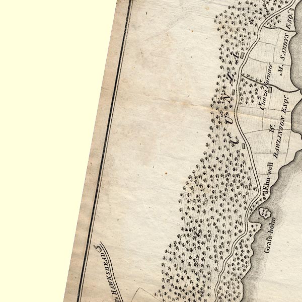 CLBSD39R.jpg 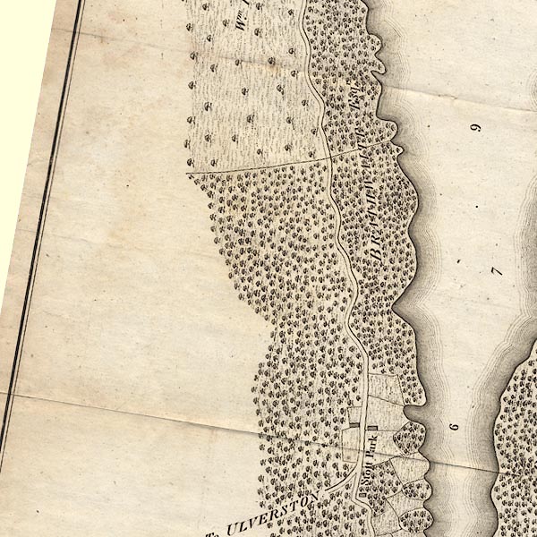 CLBSD38U.jpg 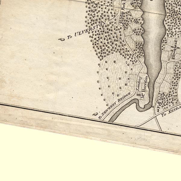 CLBSD38T.jpg "To NEWBERY BRIDGE" item:- private collection : 10.11 Image © see bottom of page |
||
|
|
|||
| evidence:- | old map:- Prior 1874 map 1 |
||
| source data:- | Map, uncoloured engraving or lithograph? Winander Mere, scale
about 2.5 miles to 1 inch, published by John Garnett,
Windermere, Westmorland, 1874.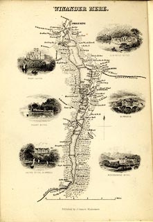 click to enlarge click to enlargePI03M1.jpg double line; road item:- private collection : 133.1 Image © see bottom of page |
||
|
|
|||
| places:- | Far Sawrey, Claife Finsthwaite, Colton Lakeside, Colton Newby Bridge |
||
|
|
|||
Lakes Guides menu.