Old Cumbria Gazetteer
 |
 |
|
||
| included in:- |
 road, Kirkby Stephen to Hawes road, Kirkby Stephen to Hawes |
|||
| road, Kirkby Stephen to Moorcock | ||||
| Kirkby Stephen to Moorcock | ||||
| Moorcock to Kirkby Stephen | ||||
| B6259 | ||||
| civil parish:- | Kirkby Stephen (formerly Westmorland) | |||
| civil parish:- | Nateby (formerly Westmorland) | |||
| civil parish:- | Mallerstang (formerly Westmorland) | |||
| county:- | Cumbria | |||
| locality type:- | road route | |||
| 10Km square:- | NY70 | |||
| 10Km square:- | SD79 | |||
| county:- | North Yorkshire | |||
| locality type:- | route | |||
| 10Km square:- | SD89 | |||
|
|
||||
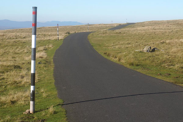 CEG21.jpg Snow poles, (taken 2.11.2015) |
||||
|
|
||||
| evidence:- | old map:- OS County Series (Yrk 50) |
|||
| source data:- | Maps, County Series maps of Great Britain, scales 6 and 25
inches to 1 mile, published by the Ordnance Survey, Southampton,
Hampshire, from about 1863 to 1948. "KIRKBY STEPHEN AND HAWES TRUST" |
|||
|
|
||||
| evidence:- | old map:- OS County Series (Wmd 36 7) placename:- Old Road |
|||
| source data:- | Maps, County Series maps of Great Britain, scales 6 and 25
inches to 1 mile, published by the Ordnance Survey, Southampton,
Hampshire, from about 1863 to 1948. The old road runs higher up on the east of Mallerstang valley. |
|||
|
|
||||
| evidence:- | old map:- Bowen and Kitchin 1760 |
|||
| source data:- | Map, hand coloured engraving, A New Map of the Counties of
Cumberland and Westmoreland Divided into their Respective Wards,
scale about 4 miles to 1 inch, by Emanuel Bowen and Thomas
Kitchin et al, published by T Bowles, Robert Sayer, and John
Bowles, London, 1760.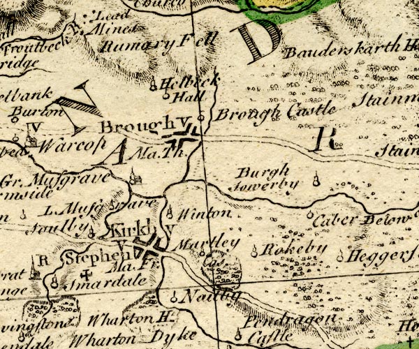 BO18NY71.jpg double line, solid 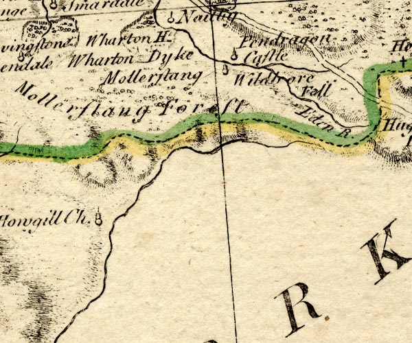 BO18NY70.jpg double line, dotted 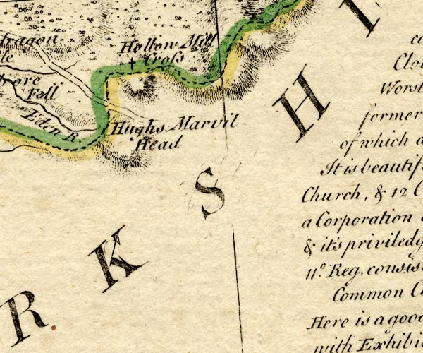 BO18NY80.jpg double line, dotted item:- Armitt Library : 2008.14.10 Image © see bottom of page |
|||
|
|
||||
| evidence:- | old map:- Jefferys 1770 (Wmd) |
|||
| source data:- | Map, 4 sheets, The County of Westmoreland, scale 1 inch to 1
mile, surveyed 1768, and engraved and published by Thomas
Jefferys, London, 1770.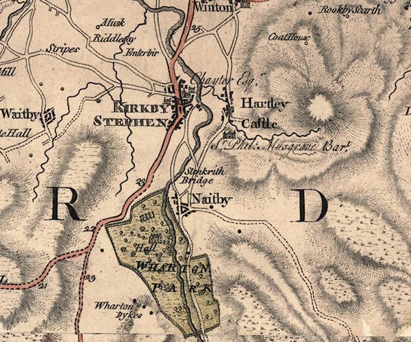 J5NY70NE.jpg 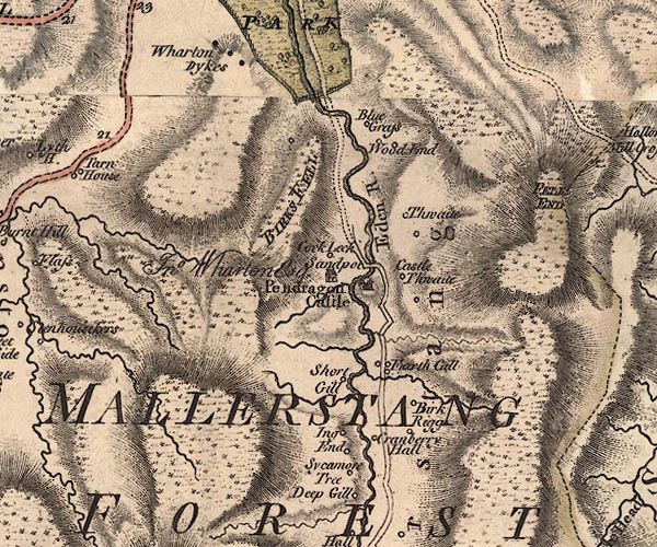 J5NY70SE.jpg 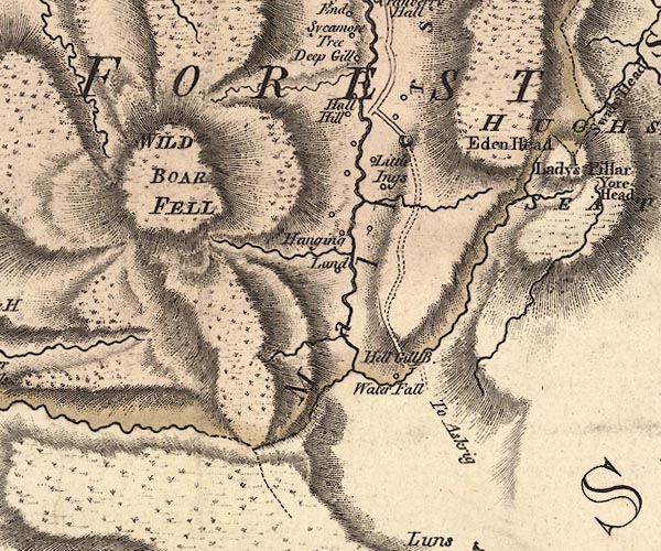 J5SD79NE.jpg "to Askrigg" double line; road item:- National Library of Scotland : EME.s.47 Images © National Library of Scotland |
|||
|
|
||||
| evidence:- | road book:- Cary 1798 (2nd edn 1802) |
|||
| source data:- | Road book, itineraries, Cary's New Itinerary, by John Cary, 181
Strand, London, 2nd edn 1802. goto source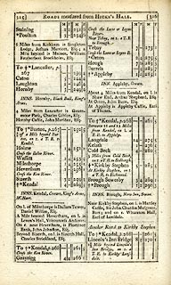 click to enlarge click to enlargeC38315.jpg page 315-316 "At Kirkby Stephen, on r. a T.R. to Richmond." goto source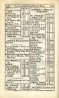 click to enlarge click to enlargeC38355.jpg page 355-356 "LONDON to Askrigg, and Kirkby Stephen." goto source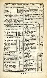 click to enlarge click to enlargeC38357.jpg page 357-358 "KIRKBY STEPHEN to Boroughbridge." part of reverse route item:- JandMN : 228.1 Image © see bottom of page |
|||
|
|
||||
| evidence:- | old map:- Laurie and Whittle 1806 |
|||
| source data:- | Road map, Continuation of the Roads to Glasgow and Edinburgh,
scale about 10 miles to 1 inch, by Nathaniel Coltman? 1806,
published by Robert H Laurie, 53 Fleet Street, London, 1834. click to enlarge click to enlargeLw21.jpg bold line; 'Principal Travelling Roads' item:- private collection : 18.21 Image © see bottom of page |
|||
|
|
||||
| evidence:- | old map:- Cooper 1808 |
|||
| source data:- | Map, hand coloured engraving, Westmoreland ie Westmorland, scale
about 9 miles to 1 inch, by H Cooper, 1808, published by R
Phillips, Bridge Street, Blackfriars, London, 1808. click to enlarge click to enlargeCOP4.jpg double line; road item:- Dove Cottage : 2007.38.53 Image © see bottom of page |
|||
|
|
||||
| evidence:- | old map:- Hall 1820 (Wmd) |
|||
| source data:- | Map, hand coloured engraving, Westmoreland ie Westmorland, scale
about 14.5 miles to 1 inch, by Sidney Hall, London, 1820,
published by Samuel Leigh, 18 Strand, London, 1820-31. click to enlarge click to enlargeHA18.jpg single line, solid; minor road; Kirkby Stephen, Nateby, ... item:- Armitt Library : 2008.14.58 Image © see bottom of page |
|||
|
|
||||
| evidence:- | gradient diagram:- Gall and Inglis 1890s-1900s (Roads) |
|||
| source data:- | Contour Road Book of England, Northern Division, by Harry R G Inglis, published by
Gall and Inglis, 25 Paternoster Square, London and Edinburgh, 1898.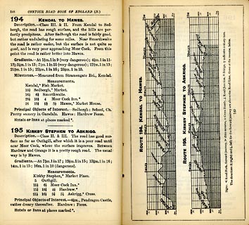 click to enlarge click to enlargeIG5194.jpg Itinerary, with gradient diagram, route 194, Kendal to Hawes, and route 195, Kirkby Stephen to Askrigg, Westmorland and Yorkshire, 1898. item:- JandMN : 763.21 Image © see bottom of page |
|||
|
|
||||
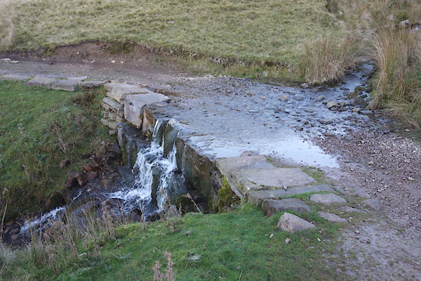
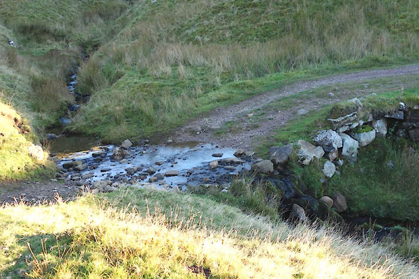
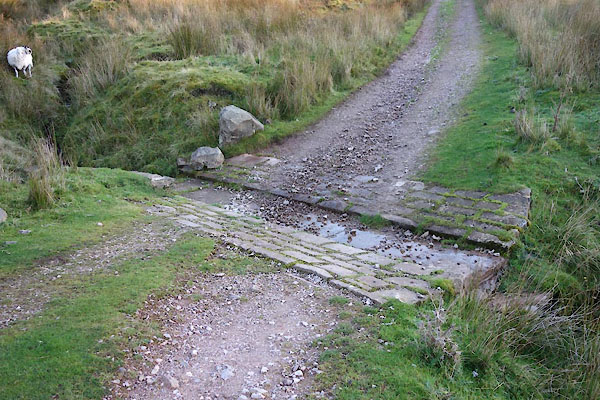
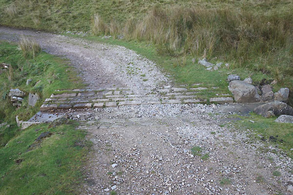
| MN photo:- |
The old road. |
|||
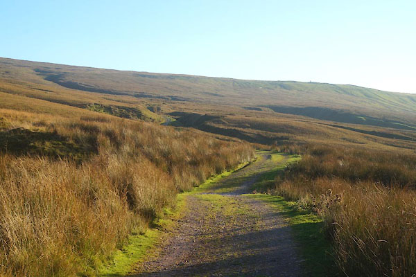 CEG83.jpg (taken 2.11.2015) 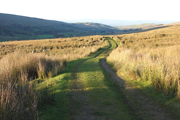 CEH39.jpg (taken 2.11.2015) |
||||
|
|
||||
| places:- | Kirkby Stephen Nateby Outhgill, Mallerstang Aisgill Farm, Mallerstang Moorcock Inn, North Yorkshire |
|||
|
|
||||
| places:- |
|
|||
|
||||
|
||||
|
||||
|
||||
Lakes Guides menu.