 Old Cumbria Gazetteer
 |
 |
|
| included in:- |
 Sedgwick Trail, Garsdale Sedgwick Trail, Garsdale |
|
| Sedgwick Trail 1, Garsdale | ||
| site name:- | Sedgwick Trail | |
| locality:- | Clough River | |
| civil parish:- | Garsdale (formerly Yorkshire) | |
| county:- | Cumbria | |
| locality type:- | trail point | |
| coordinates:- | SD69819127 | |
| 1Km square:- | SD6991 | |
| 10Km square:- | SD69 | |
|
|
||
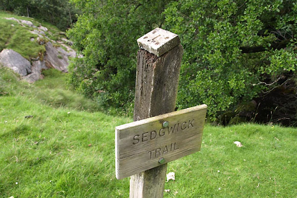 BWX87.jpg Viewpoints are marked by a post and number. Viewpoint 1. (taken 22.7.2012) 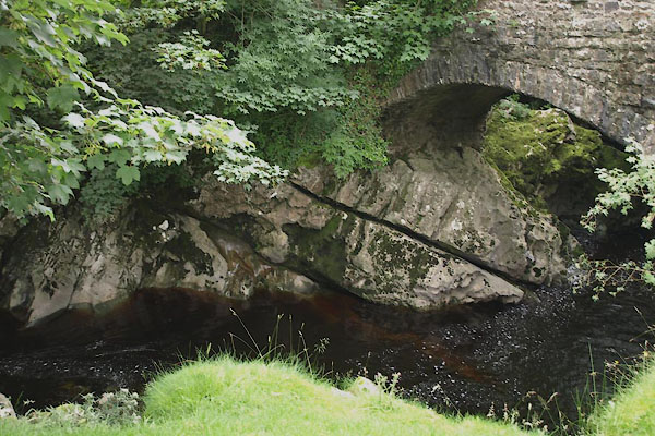 BWY48.jpg Great Scar Limestone, exposed at Danny Bridge. (taken 27.7.2012) |
||
| The bedrock is Great Scar Limestone, Lower Carboniferous, about 330 Myrs old. Sedimentary
rocks are laid down horizontally but have been tilted since by the movement of the
Dent Fault. The angle of dip here is about 60 degrees - though the exposure appears
to be at 30 degrees. What were vertical joints can be seen at right angles to the
bedding plane. |
||
|
|
||
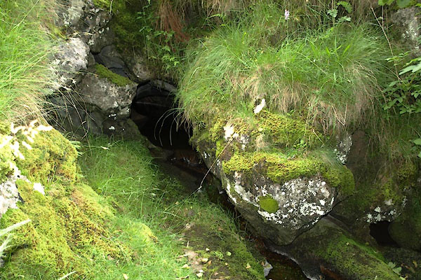 BWY49.jpg Danny Cave. (taken 27.7.2012) |
||
| Limestone is easily eroded into caves. Danny Cave below the viewpoint has a small
stream issuing out of it. |
||
|
|
||
Lakes Guides menu.