 Old Cumbria Gazetteer
 |
 |
|
|
| Westmorland: threapland 3 | |||
| Disputed Ground | |||
| locality:- | Stainmore Common | ||
| civil parish:- | Stainmore (formerly Westmorland) | ||
| county:- | Cumbria | ||
| locality type:- | threapland | ||
| locality type:- | county boundary | ||
| coordinates:- | NY876157 (etc) | ||
| 1Km square:- | NY8715 | ||
| 10Km square:- | NY81 | ||
| county:- | Durham | ||
|
|
|||
| evidence:- | old map:- Cary 1789 (edn 1805) |
||
| source data:- | Map, uncoloured engraving, Westmoreland, scale about 2.5 miles
to 1 inch, by John Cary, London, 1789; edition 1805.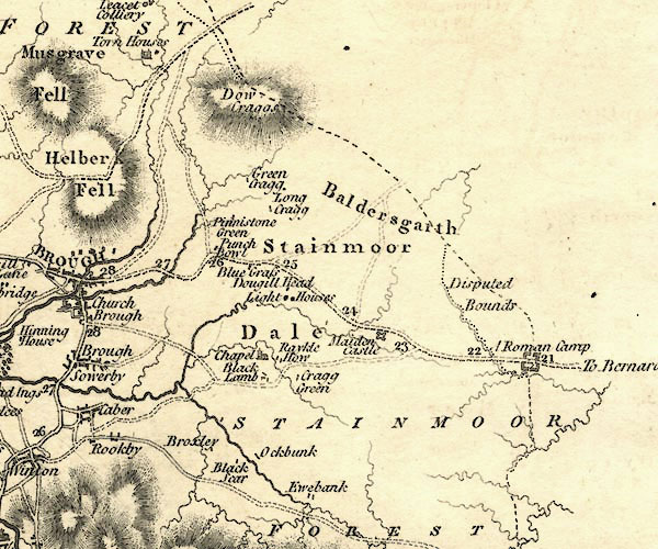 CY24NY81.jpg "Disputed Bounds" area item:- JandMN : 129 Image © see bottom of page |
||
|
|
|||
| evidence:- | old map:- Greenwood 1824 |
||
| source data:- | Map, hand coloured engraving, Map of the County of Westmorland,
scale about 1 inch to 1 mile, by C and J Greenwood, published by
George Pringle jnr, 70 Queen Street, Cheapside, London, 1824.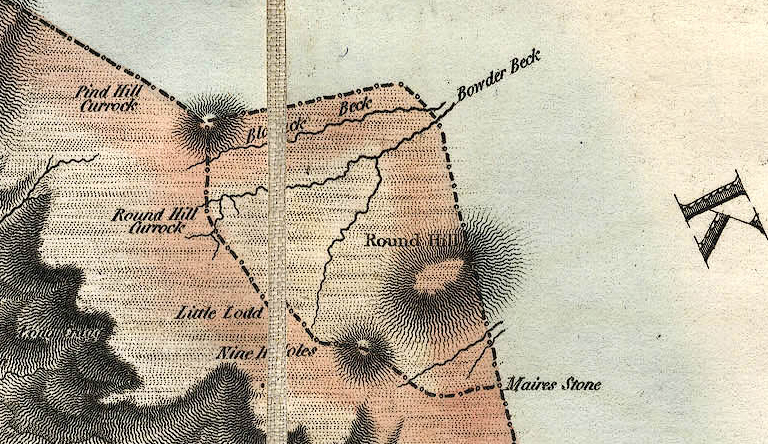 GRW5Th03.jpg two boundaries item:- Armitt Library : A1827 Image © see bottom of page |
||
|
|
|||
| evidence:- | old map:- Greenwood 1834 |
||
| source data:- | Map, hand coloured engraving, Map of the County of Westmorland,
scale about 3 miles to 1 inch, by C and J Greenwood, 1822-23,
engraved by J and C Walker, 1830, published by Greenwood and Co,
13 Regent Street, Pall Mall, London, 1830-34.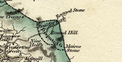 GRW7Th03.jpg "Disputed G" item:- Dove Cottage : 2007.38.25 Image © see bottom of page |
||
|
|
|||
| evidence:- | old map:- Dugdale 1835 |
||
| source data:- | Map, hand coloured engraving, Westmoreland ie Westmorland, scale
about 5.5 miles to 1 inch, by J Archer, Pentonville, London,
about 1835, version about 1847?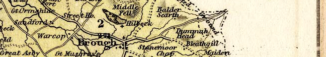 AR17Th03.jpg "[Disputed] Ground" item:- JandMN : 318 Image © see bottom of page |
||
|
|
|||
| evidence:- | old map:- Walker 1837 |
||
| source data:- | Map, Westmorland, scale about 3 miles to 1 inch, by J and C
Walker, about 1837, published by Longman, Rees, Orme, Brown,
Etc, Paternoster Row, London, 1837, edition about 1860s.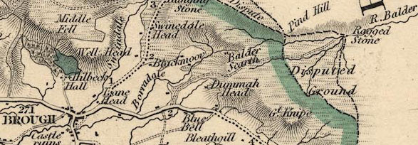 WKR4Th03.jpg "Disputed Groound" item:- JandMN : 122 Image © see bottom of page |
||
|
|
|||
| evidence:- | old map:- Letts 1884 |
||
| source data:- | Map, colour printed, Westmoreland ie Westmorland, scale about 3
miles to 1 inch, published by Letts, Son and Co, London Bridge,
London, 1884.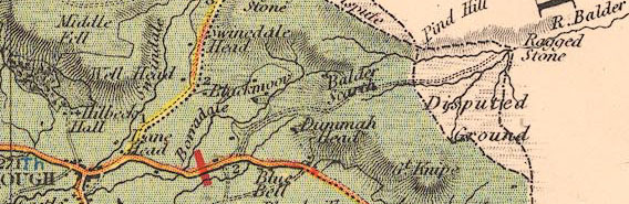 LET2Th03.jpg "Disputed Ground" item:- JandMN : 17 Image © see bottom of page |
||
|
|
|||
| evidence:- | old map:- Bartholomew 1940s |
||
| source data:- | Map, colour lithograph, Bartholomew's Revised Half Inch
Contoured Maps, sheet 35, Teesdale, scale about 2 miles to 1
inch, by John Bartholomew and Sons, The Edinburgh Geographical
Institute, Duncan Street, Edinburgh, Lothian, Scotland, 1952.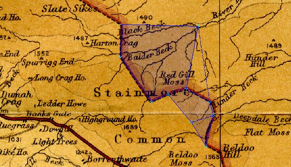 BA22Th03.jpg item:- JandMN : 828.35 Image © see bottom of page |
||
|
|
|||
| mapping:- |  Pind Hill, Stainmore Great Dodd, Stainmore Rise Gill Foot, Stainmore West Mere, Durham Deepdale Head, Stainmore Nine Holes, Stainmore Little Dodd, Stainmore Round Hill, Stainmore Pind Hill, Stainmore Pind Hill, Stainmore Great Dodd, Stainmore Rise Gill Foot, Stainmore West Mere, Durham Deepdale Head, Stainmore Nine Holes, Stainmore Little Dodd, Stainmore Round Hill, Stainmore Pind Hill, Stainmore |
||
|
|
|||
| mapping:- | Pind Hill, Stainmore Round Hill, Stainmore Little Dodd, Stainmore Great Dodd, Stainmore Rise Gill Foot, Stainmore West Mere, Durham Deepdale Head, Stainmore |
||
|
|
|||
Lakes Guides menu.