 |
 |
|
|
|
| runs into:- |
 Petteril, River Petteril, River |
|
|
|
|
|
|
| civil parish:- |
Greystoke (formerly Cumberland) |
| county:- |
Cumbria |
| locality type:- |
river |
| 1Km square:- |
NY4430 (etc) |
| 10Km square:- |
NY43 |
| SummaryText:- |
Made into a lake in the grounds of Greystoke Castle. |
|
|
| evidence:- |
old map:- OS County Series (Cmd 58 1)
placename:- North Petterill
|
| source data:- |
Maps, County Series maps of Great Britain, scales 6 and 25
inches to 1 mile, published by the Ordnance Survey, Southampton,
Hampshire, from about 1863 to 1948.
|
|
|
| evidence:- |
old map:- Donald 1774 (Cmd)
|
| source data:- |
Map, hand coloured engraving, 3x2 sheets, The County of Cumberland, scale about 1
inch to 1 mile, by Thomas Donald, engraved and published by Joseph Hodskinson, 29
Arundel Street, Strand, London, 1774.
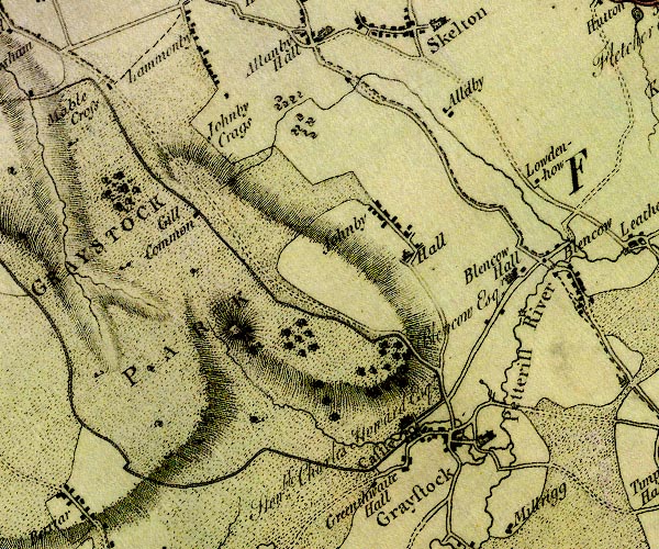
D4NY43SW.jpg
single or double wiggly line; a river into the Petteril at Greystoke
item:- Carlisle Library : Map 2
Image © Carlisle Library |
|
|
| places:- |
|
NY44423067 bridge, Greystoke (Greystoke) |
|
|
|
NY4330 Graystoke Mill (Greystoke) suggested |
|
|
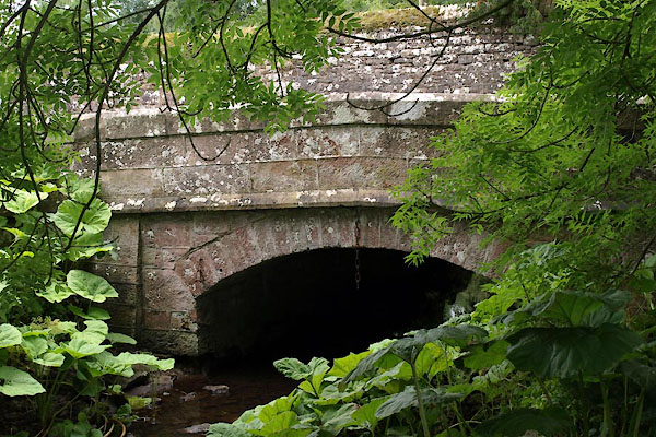 |
NY44003105 Sharkey Bridge, Greystoke (Greystoke) |
|
|
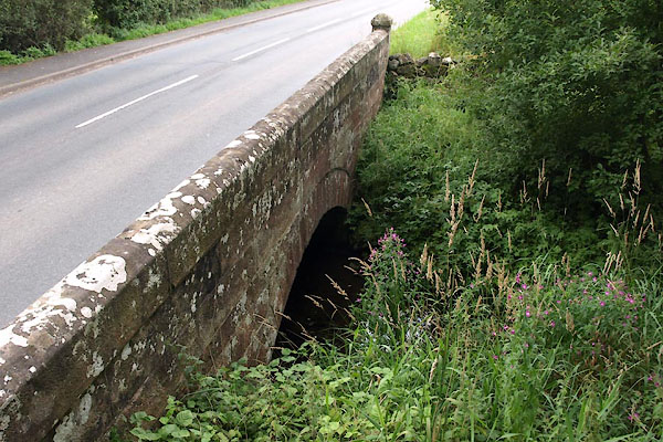 |
NY44163093 Thorpe Bridge (Greystoke) |
|
|
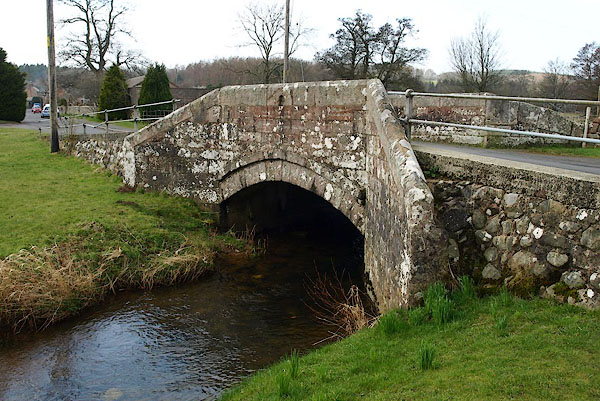 |
NY44243078 War Memorial Bridge (Greystoke) L |
|
