 Donald 1774

|

|
|

|
menu with map squares and placename index | |
|
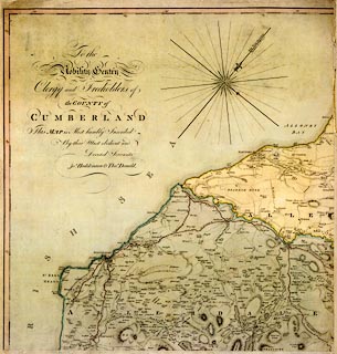
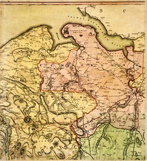
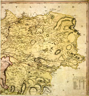
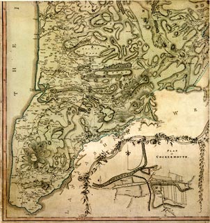
Map, hand coloured engraving, 3x2 sheets, The County of
Cumberland, scale about 1 inch to 1 mile, by Thomas Donald,
engraved and published by Joseph Hodskinson, 29 Arundel
Street, Strand, London, 1774.
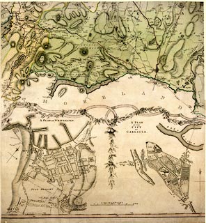
There are inset maps, scale about 13 inches to 1 mile - Plan of Cockermouth on sheet 4; and Plan of Whitehaven, noticably larger than the city, and Plan of the City of Carlisle, with town walls and gates etc, on sheet 5. In the EXPLANATION to the map it says:- '... In this Survey the Horizontal Distances are deduced (by Trigonometrical Calulation) from a Base line measured in Level Ground, the Roads, Rivers, &c. actually Surveyed and truly delineated.' The map was commissioned by Mr Jefferys. |
||
|
|
Donald 1774 | |
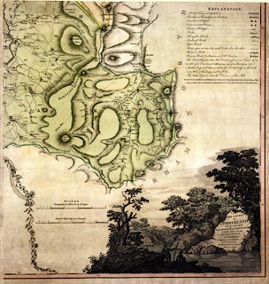
| map feature:- | pictorial cartouche & dedication & table of symbols (sheet 6) & compass rose & up is NW & magnetic deviation & scale lines & lat and long scales (West of London) & sea plain & coast form lines & rivers & bridges & lakes & relief & hill hachuring & table of heights (sheet 3, The Perpendicular Height of Mountains above the Surface of the Sea and Bassenthwaite Water - eg Skiddaw 1090 yards above the sea, 958 above Bassenthwaite Water) & woods & forests & parks & county & wards & settlements & roads & road distances & turnpike roads & inset map | |
| inscription:- |
printed lower right, sheet 6
THE COUNTY / OF / CUMBERLAND / SURVEYED / Anno MDCCLXX and MDCCLXXI, by / THOS. DONALD. / at the request of the late / Mr. JEFFERYS / Geographer to the KING, / and Engraved by J. HODSKINSON, / MDCCLXXIV. |
|
| inscription:- |
printed lower right of pictorial cartouche
I. Best Sculp |
|
| inscription:- |
printed bootom right
LONDON, Publish'd according to Act of Parliament 25th. March 1774. / by J. Hodskinson No.29 Arundel Street Strand. |
|
| inscription:- |
printed upper left, sheet 1
To the / Nobility Gentry / Clergy and Freeholders of / the COUNTY of / CUMBERLAND / This MAP is Most humbly Inscribed / By their Most obedient and / Devoted Servants / Jos. Hodskinson & Thos. Donald. |
|
| inscription:- |
printed with scale line
SCALES / Geographical Miles 60 to a Degree |
|
| scale line:- | 4+1 miles = 145.3 mm | |
| inscription:- |
printed with scale line
Statute Miles 69 1/2 to a Degree |
|
| scale line:- | 5+1 miles = 151.8 mm | |
| inscription:- |
printed with scale line
A SCALE TO THE PLANS |
|
| scale line:- | 500+100 yards = 113.6 mm | |
| wxh, single sheet:- | 56x59cm (about) | |
| wxh, map:- | 1630x1149mm (estimate) | |
| scale:- | 1 to 64000 ? (1 to 63610 from scale line, statute miles) | |
| scale, town plans:- | 1 to 4800 ? (1 to 4830 from scale line, assuming ) | |