 Morden 1695 (Wmd) NY30


|

|
|
|
gazetteer links places may or may not be labelled on the map |
||

|
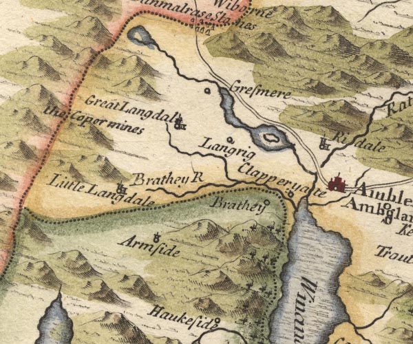
-- Ambleside -- "Ambleside / Amboglana" |
|
|
|
-- Brathay, River -- "Brathey R" |
|
|
|
-- Clappersgate -- "Clapperyate" |
|
|
|
-- Coniston Copper Mines -- "the Copermines" |
|
|
|
-- Easedale Beck |
|
|
|
-- Easedale Tarn |
|
|
|
-- Grasmere -- "Gresmere" |
|
|
|
-- Grasmere |
|
|
|
-- Great Langdale Beck |
|
|
|
-- Great Langdale -- "Great Langdal" |
|
|
|
-- Heron Island |
|
|
|
-- High Arnside -- "Armside" |
|
|
|
-- Loughrigg -- "Langrig" |
|
|
|
-- Low Arnside -- "Armside" |
|
|
|
-- Old Brathay -- "Brathey" |
|
|
|
-- Ambleside to Keswick -- "The way from Cokermouth &
Kenswick to Kendall" |
|
|
|
-- Rothay, River |
|
|
|
-- Rydal Bridge |
|
|
|
-- Rydal Water |
|
|
|
-- Rydal -- "Ridale" |
|
|
|
-- Stock Ghyll |
|
|
|
-- Windermere lake -- "Winander Mere" |
|
|
civil parishes The area roughly includes parts of parishes:- Claife Lakes Windermere Skelwith Coniston Patterdale |
||
|
|
||
|
|
Lakes Guides menu. | |