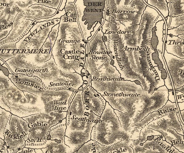
 Otley 1818 NY21


|

|
|
|
gazetteer links places may or may not be labelled on the map |
||

|
-- Armboth |
|
|
|
-- Borrowdale Graphite Mine (?) |
|
|
|
-- Blea Tarn |
|
|
|
-- Borrowdale -- "BORROWDALE" |
|
|
|
-- Bowder Stone |
|
|
|
-- Castle Crag |
|
|
|
-- Cat Bells |
|
|
|
-- Grange |
|
|
|
-- Great Gable |
|
|
|
-- Lodore |
|
|
|
-- Newlands Valley (?) -- "NEWLANDS" |
|
|
|
-- Rosthwaite |
|
|
|
-- Seathwaite |
|
|
|
-- Seatoller |
|
|
|
-- Stonethwaite |
|
|
|
-- Taylorgill Force |
|
|
|
-- Seathwaite to Wasdale Head |
|
|
|
-- Watendlath Beck |
|
|
|
-- Watendlath Tarn |
|
|
|
-- Watendlath |
|
|
|
-- waterfall, Seathwaite Slabs |
|
|
civil parishes The area roughly includes parts of parishes:- St John's Castlerigg and Wythburn Buttermere Borrowdale Above Derwent Nether Wasdale Keswick Ennerdale and Kinniside Lakes |
||
|
|
||
|
|
Lakes Guides menu. | |