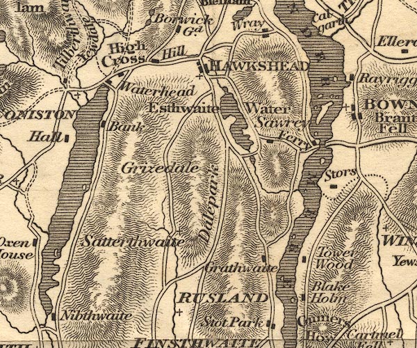
 Otley 1818 SD39


|

|
|
|
gazetteer links places may or may not be labelled on the map |
||

|
-- Belle Isle |
|
|
|
-- Blake Holme Plantation |
|
|
|
-- Coniston Water |
|
|
|
-- Coniston -- "CONISTON" |
|
|
|
-- Dale Park |
|
|
|
-- Esthwaite Water |
|
|
|
-- Far Sawrey |
|
|
|
-- Graythwaite Hall |
|
|
|
-- Graythwaite Old Hall |
|
|
|
-- Hawkshead Hill |
|
|
|
-- Hawkshead -- "HAWKSHEAD" |
|
|
|
-- High Bank Ground |
|
|
|
-- High Cross |
|
|
|
-- Low Bank Ground |
|
|
|
-- Near Sawrey |
|
|
|
-- Out Dubs Tarn |
|
|
|
-- Rusland Cross -- "RUSLAND" |
|
|
|
-- Rusland -- "RUSLAND" |
|
|
|
-- Satterthwaite |
|
|
|
-- Storrs Hall |
|
|
|
-- Tower Wood |
|
|
|
-- Water Head |
|
|
|
-- Windermere Ferry (?) |
|
|
|
-- Windermere lake -- "WINDERMERE" |
|
|
civil parishes The area roughly includes parts of parishes:- Torver Satterthwaite Claife Lakes Colton Windermere Hawkshead Cartmel Fell Coniston |
||
|
|
||
|
|
Lakes Guides menu. | |