 Saxton 1576 NY40


|

|
|
|
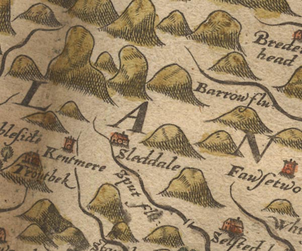
gazetteer links places may or may not be labelled on the map |
||

|
-- Borrow Beck -- "Barrow flu:" |
|
|
|
-- Garnett Bridge |
|
|
|
-- Kent, River |
|
|
|
-- Kentmere -- "Kentmere" |
|
|
|
-- Longsleddale -- "Sleddale" |
|
|
|
-- Sprint, River -- "Sput flu:" |
|
|
civil parishes The area roughly includes parts of parishes:- Kentmere Shap Rural Hugill Strickland Roger Longsleddale Over Staveley Patterdale Lakes Windermere |
||
|
|
||
|
|
Lakes Guides menu. | |