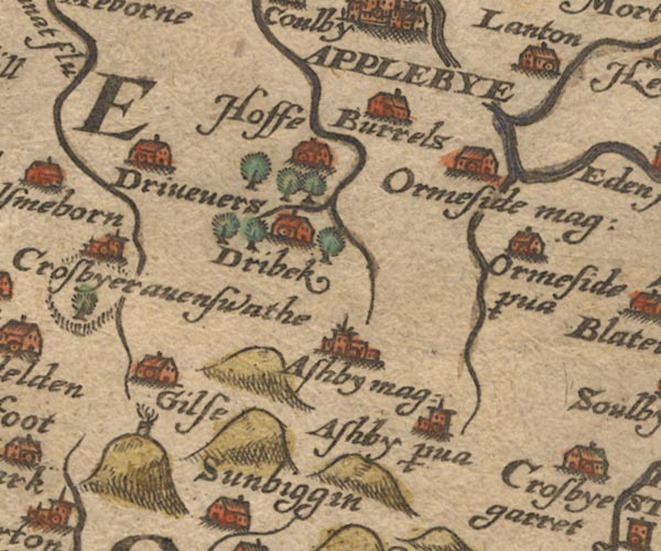
 Saxton 1576 NY61


|

|
|
|
gazetteer links places may or may not be labelled on the map |
||

|
-- Beacon Hill |
|
|
|
-- Burrells -- "Burrels" |
|
|
|
-- Dry Beck |
|
|
|
-- Drybeck -- "Dribek" |
|
|
|
-- Dryevers -- "Drivevers" |
|
|
|
-- Gilts -- "Gilse" |
|
|
|
-- Great Asby -- "Ashby mag:" |
|
|
|
-- Great Ormside -- "Oremside mag:" |
|
|
|
-- Helm Beck |
|
|
|
-- Hilton Beck |
|
|
|
-- Hoff -- "Hoffe" |
|
|
|
-- Hoff Lunn |
|
|
|
-- Langton -- "Lanton" |
|
|
|
-- Little Asby -- "Ashby p~va" |
|
|
|
-- Little Ormside -- "Ormeside p~va" |
|
|
|
-- Lyvennet Beck |
|
|
civil parishes The area roughly includes parts of parishes:- Crosby Ravensworth Hoff Orton S Asby Ormside Sleagill Colby King's Meaburn Appleby-in-Westmorland Murton |
||
|
|
||
|
|
Lakes Guides menu. | |