 Saxton 1576 NY74


|

|
|
|
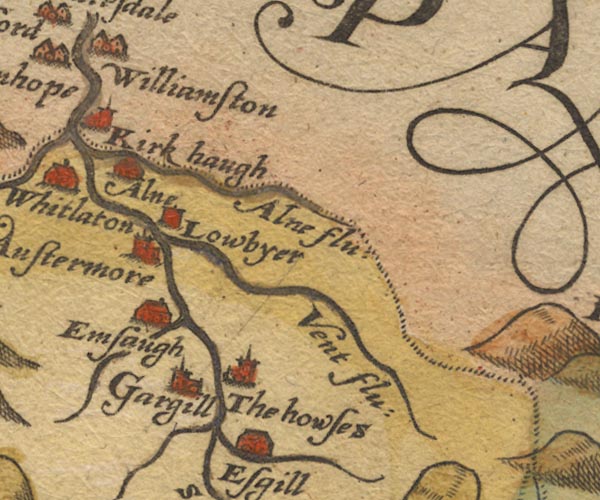
gazetteer links places may or may not be labelled on the map |
||

|
-- Alston -- "Austermore" |
|
|
|
-- Ash Gill |
|
|
|
-- Ayle Burn -- "Alne flu:" |
|
|
|
-- Ayle -- "Alne" |
|
|
|
-- Black Burn |
|
|
|
-- Cross Gill |
|
|
|
-- Garrigill -- "Gargill" |
|
|
|
-- Kirkhaugh -- "Kirk haugh" |
|
|
|
-- Low Ameshaugh -- "Emsaugh" |
|
|
|
-- Low Byre (?) -- "Lowbyer" |
|
|
|
-- Low Houses -- "The howses" |
|
|
|
-- Middle Houses -- "The howses" |
|
|
|
-- Nent, River -- "Vent flu:" |
|
|
|
-- South Tyne, River -- "S: Tyne flu:" |
|
|
|
-- Williamston -- "Williamston" |
|
|
civil parishes The area roughly includes parts of parishes:- Alston Moor |
||
|
|
||
|
|
Lakes Guides menu. | |