 Saxton 1576 SD18


|

|
|
|
gazetteer links places may or may not be labelled on the map |
||

|
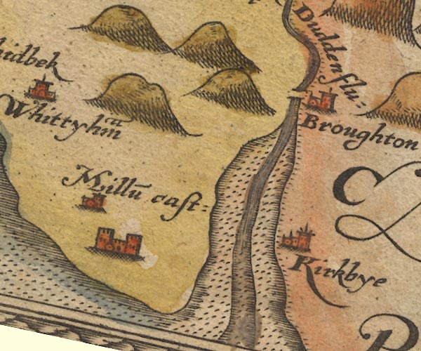
-- Broughton in Furness -- "Broughton" |
|
|
|
-- Duddon Bridge |
|
|
|
-- Duddon Estuary |
|
|
|
-- Duddon, River -- "Dudden flu:" |
|
|
|
-- Kirkby-in-Furness -- "Kirkbye" |
|
|
|
-- Millom -- "Millu~" |
|
|
|
-- Millom Castle -- "Millu~ cast:" |
|
|
civil parishes The area roughly includes parts of parishes:- Broughton West Millom Millom Without Ulpha Dunnerdale-with-Seathwaite Whicham Waberthwaite Bootle |
||
|
|
||
|
|
Lakes Guides menu. | |