 Saxton 1576 SD57


|

|
|
|
gazetteer links places may or may not be labelled on the map |
||

|
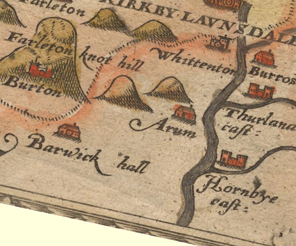
-- Arkholme -- "Arum" |
|
|
|
-- Borwick Hall -- "Barwick hall" |
|
|
|
-- Greta, River |
|
|
|
-- Hornby Castle -- "Hornbye cast:" |
|
|
|
-- Lune, River -- "Lune flu:" |
|
|
|
-- Wenning, River |
|
|
|
-- Whittington -- "Whittendon" |
|
|
civil parishes The area roughly includes parts of parishes:- Hutton Roof Lupton Beetham Holme Burton-in-Kendal Kirkby Lonsdale |
||
|
|
||
|
|
Lakes Guides menu. | |