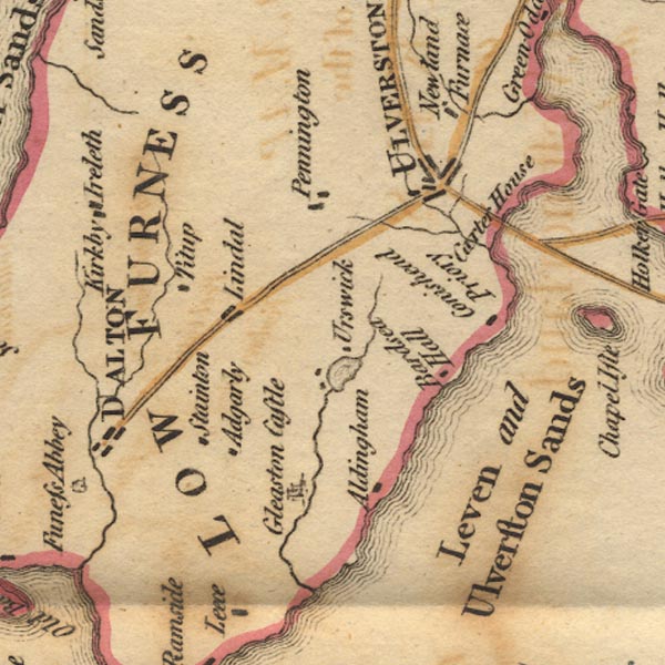
 West 1784 map SD27


|

|
|
|
gazetteer links places may or may not be labelled on the map |
||

|
-- Aldingham |
|
|
|
-- Bardsea Hall (?) |
|
|
|
-- Carter House (?) |
|
|
|
-- Conishead Priory |
|
|
|
-- Furness -- "LOW FURNESS" |
|
|
|
-- Gleaston Castle |
|
|
|
-- Great Urswick |
|
|
|
-- Levy Beck |
|
|
|
-- Lindal in Furness |
|
|
|
-- Pennington |
|
|
|
-- Stainton with Adgarley |
|
|
|
-- Tytup Hall |
|
|
|
-- Ulverston Sands -- "Leven and Ulverston Sands" |
|
|
|
-- Ulverston -- "ULVERSTON" |
|
|
|
-- Urswick Tarn |
|
|
civil parishes The area roughly includes parts of parishes:- Dalton Town with Newton Aldingham Ulverston Osmotherley Egton with Newland Pennington Lindal and Marton Mansriggs Urswick Kirkby Ireleth Askam and Ireleth Barrow-in-Furness |
||
|
|
||
|
|
Lakes Guides menu. | |