 Old Cumbria Gazetteer
 |
 |
|
| Barrock Park, Hesket | ||
| Barrock Park | ||
| civil parish:- | Hesket (formerly Cumberland) | |
| county:- | Cumbria | |
| locality type:- | buildings | |
| locality type:- | park | |
| coordinates:- | NY45184639 | |
| 1Km square:- | NY4546 | |
| 10Km square:- | NY44 | |
|
|
||
| evidence:- | old map:- OS County Series (Cmd 31 10) placename:- Barrock Park |
|
| source data:- | Maps, County Series maps of Great Britain, scales 6 and 25
inches to 1 mile, published by the Ordnance Survey, Southampton,
Hampshire, from about 1863 to 1948. |
|
|
|
||
| evidence:- | just possibly old map:- Bowen and Kitchin 1760 |
|
| source data:- | Map, hand coloured engraving, A New Map of the Counties of
Cumberland and Westmoreland Divided into their Respective Wards,
scale about 4 miles to 1 inch, by Emanuel Bowen and Thomas
Kitchin et al, published by T Bowles, Robert Sayer, and John
Bowles, London, 1760.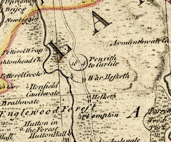 BO18NY44.jpg circle, tower item:- Armitt Library : 2008.14.10 Image © see bottom of page |
|
|
|
||
| evidence:- | old map:- Ford 1839 map placename:- Barrock Lodge |
|
| source data:- | Map, uncoloured engraving, Map of the Lake District of
Cumberland, Westmoreland and Lancashire, scale about 3.5 miles
to 1 inch, published by Charles Thurnam, Carlisle, and by R
Groombridge, 5 Paternoster Row, London, 3rd edn 1843.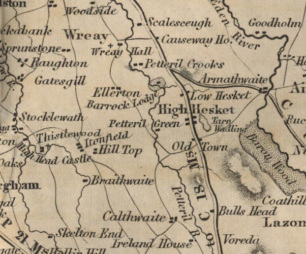 FD02NY44.jpg "Barrock Lodge" Building and park. item:- JandMN : 100.1 Image © see bottom of page |
|
|
|
||
| evidence:- | database:- Listed Buildings 2010 placename:- Manor, The |
|
| source data:- | courtesy of English Heritage "THE MANOR / / / HESKET / EDEN / CUMBRIA / II / 73869 / NY4517846391" |
|
|
|
||
 Lakes Guides menu.