 Old Cumbria Gazetteer
 |
 |
|
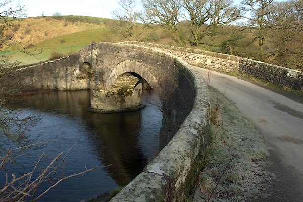
| Crook of Lune Bridge, Sedbergh | ||
| Crook of Lune Bridge | ||
| site name:- | Lune, River | |
| civil parish:- | Grayrigg (formerly Westmorland) | |
| civil parish:- | Sedbergh (formerly Yorkshire) | |
| county:- | Cumbria | |
| locality type:- | bridge | |
| coordinates:- | SD62049631 | |
| 1Km square:- | SD6296 | |
| 10Km square:- | SD69 | |
| old boundary | ||
| locality:- | Westmorland boundary | |
| locality:- | Yorkshire boundary | |
|
|
||
 BJV92.jpg (taken 23.9.2005) 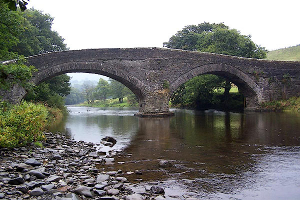 BJV91.jpg (taken 23.9.2005) |
||
|
|
||
| evidence:- | old map:- OS County Series (Wmd 34 12) placename:- Crook of Lune Bridge |
|
| source data:- | Maps, County Series maps of Great Britain, scales 6 and 25
inches to 1 mile, published by the Ordnance Survey, Southampton,
Hampshire, from about 1863 to 1948. |
|
|
|
||
| evidence:- | old map:- OS County Series (Yrk 48 6) placename:- Crook of Lune Bridge |
|
| source data:- | Maps, County Series maps of Great Britain, scales 6 and 25
inches to 1 mile, published by the Ordnance Survey, Southampton,
Hampshire, from about 1863 to 1948. |
|
|
|
||
| evidence:- | old map:- Saxton 1579 |
|
| source data:- | Map, hand coloured engraving, Westmorlandiae et Cumberlandiae Comitatus ie Westmorland
and Cumberland, scale about 5 miles to 1 inch, by Christopher Saxton, London, engraved
by Augustinus Ryther, 1576, published 1579-1645.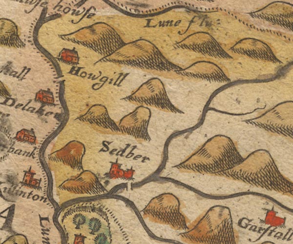 Sax9SD69.jpg By Howgill; over River Lune. item:- private collection : 2 Image © see bottom of page |
|
|
|
||
| evidence:- | old map:- Jansson 1646 |
|
| source data:- | Map, hand coloured engraving, Cumbria and Westmoria, ie
Cumberland and Westmorland, scale about 3.5 miles to 1 inch, by
John Jansson, Amsterdam, Netherlands, 1646.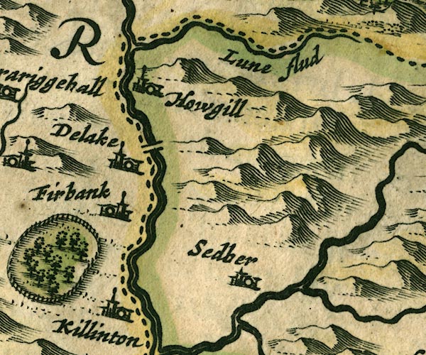 JAN3SD69.jpg Double line crossing the stream; at county boundary. item:- JandMN : 88 Image © see bottom of page |
|
|
|
||
| evidence:- | old map:- Seller 1694 (Wmd) |
|
| source data:- | Map, hand coloured engraving, Westmorland, scale about 8 miles
to 1 inch, by John Seller, 1694. click to enlarge click to enlargeSEL7.jpg two lines cross a stream; bridge item:- Dove Cottage : 2007.38.87 Image © see bottom of page |
|
|
|
||
| evidence:- | old map:- Morden 1695 (Wmd) |
|
| source data:- | Map, hand coloured engraving, Westmorland, scale about 2.5 miles to 1 inch, by Robert
Morden, published by Abel Swale, the Unicorn, St Paul's Churchyard, Awnsham, and John
Churchill, the Black Swan, Paternoster Row, London, 1695.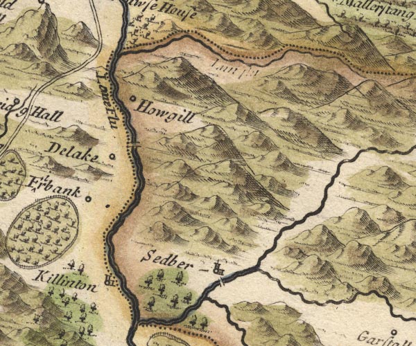 MD10SD69.jpg Double line over the Lune south of Howgill. item:- JandMN : 24 Image © see bottom of page |
|
|
|
||
| evidence:- | old map:- Jefferys 1770 (Wmd) |
|
| source data:- | Map, 4 sheets, The County of Westmoreland, scale 1 inch to 1
mile, surveyed 1768, and engraved and published by Thomas
Jefferys, London, 1770.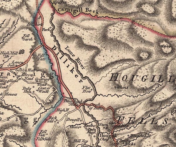 J5SD69NW.jpg double line, road, across a stream; bridge item:- National Library of Scotland : EME.s.47 Image © National Library of Scotland |
|
|
|
||
| evidence:- | old map:- Cary 1789 (edn 1805) |
|
| source data:- | Map, uncoloured engraving, Westmoreland, scale about 2.5 miles
to 1 inch, by John Cary, London, 1789; edition 1805.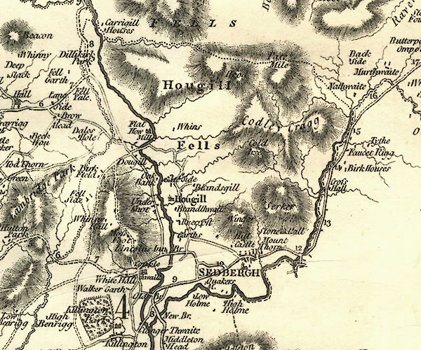 CY24SD69.jpg road across a stream; bridge over the Lune item:- JandMN : 129 Image © see bottom of page |
|
|
|
||
| evidence:- | database:- Listed Buildings 2010 placename:- Crook of Lune Bridge |
|
| source data:- | courtesy of English Heritage "CROOK OF LUNE BRIDGE (THAT PART IN GRAYRIGG CP) / / / GRAYRIGG / SOUTH LAKELAND / CUMBRIA / II[star] / 75653 / SD6203396311" |
|
| source data:- | courtesy of English Heritage "CROOK OF LUNE BRIDGE THAT PART IN SEDBERGH CP / / HOWGILL LANE / SEDBERGH / SOUTH LAKELAND / CUMBRIA / II[star] / 484577 / SD6203396312" |
|
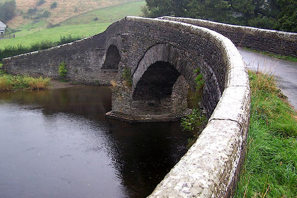
| source data:- | courtesy of English Heritage "Bridge over river Lune. C17 or C18 with later parapets. 2 unequal segmental arches with triangular cutwaters, that on south side with bowed upper part. Plain parapets, of different builds to either side of central vertical stone, e.g. those to east have reeded coping. Abutments curve forward. Roadway is approx. 3m wide. Part of this item is in Sedbergh RDC." |
|
| source data:- | courtesy of English Heritage "Public road bridge over River Lune. Believed to be C16 or earlier; altered. Roughly coursed mixed rubble. Two slightly asymmetrical segmental arches with voussoirs of long thin rubble and stone-slate arch-bands, springing from a pier and plinth with triangular cutwaters both up- and downstream, carried up as battered triangular buttresses. Humped and unusually narrow deck (approx. 2 metres), rising from west end and protected by re-built parapets of coursed rubble, curved outwards over splayed abutments. Forms part of ancient north-south route along Lunesdale, used in C17 and C18 by drovers. A very picturesque feature in this setting. (The western half of this item is in Grayrigg CP.)" |
|
|
|
||
 BVU35.jpg (taken 13.1.2012) 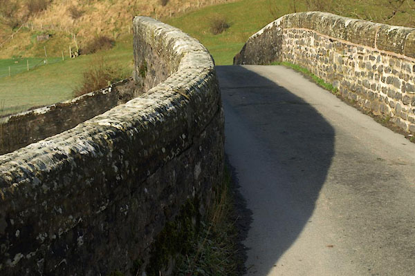 BVU36.jpg (taken 13.1.2012) 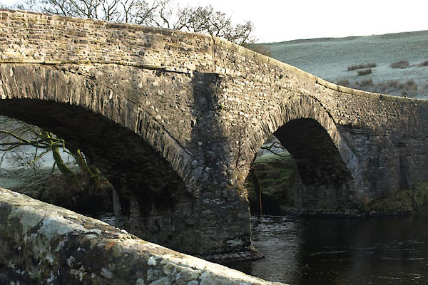 BVU37.jpg (taken 13.1.2012) 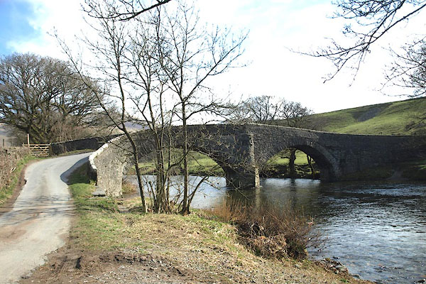 BOX73.jpg (taken 31.3.2008) 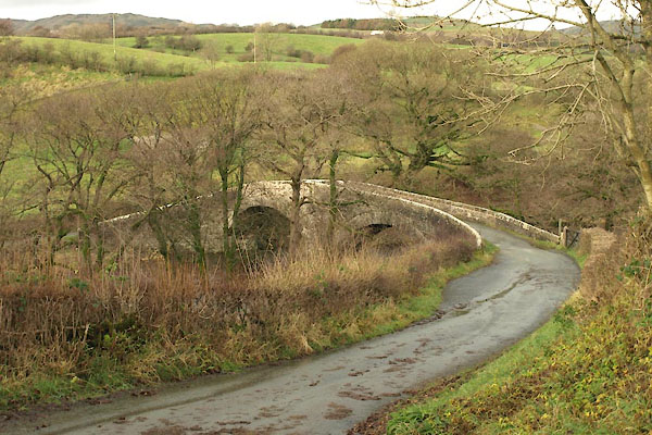 BXR47.jpg (taken 23.11.2012) 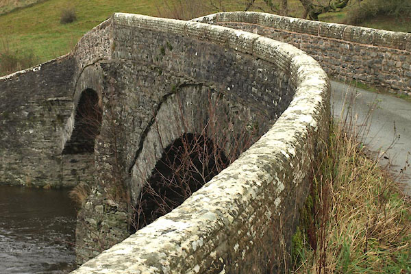 BXR48.jpg (taken 23.11.2012) 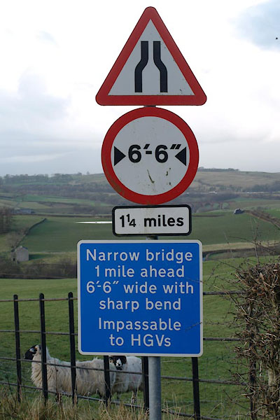 BXQ99.jpg Roadsign at Four Lane Ends, (taken 31.3.2008) |
||
|
|
||
 Lakes Guides menu.