 Old Cumbria Gazetteer
 |
 |
|
| Broughton in Furness Station, Broughton in Furness | ||
| Broughton in Furness Station | ||
| Broughton Station | ||
| site name:- | Furness Railway | |
| site name:- | Coniston Railway | |
| locality:- | Broughton in Furness | |
| civil parish:- | Broughton West (formerly Lancashire) | |
| county:- | Cumbria | |
| locality type:- | railway station | |
| coordinates:- | SD21238741 | |
| 1Km square:- | SD2187 | |
| 10Km square:- | SD28 | |
| SummaryText:- | 2nd station, opened for Coniston branch as Broughton Station 1859; renamed Broughton-in-Furness Station 1928; closed 1958. | |
|
|
||
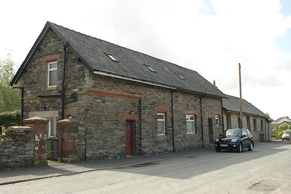 BTJ70.jpg (taken 25.8.2010) |
||
|
|
||
| evidence:- | old map:- OS County Series (Lan 6 12) placename:- Broughton Station item:- weighing machine; goods shed |
|
| source data:- | Maps, County Series maps of Great Britain, scales 6 and 25
inches to 1 mile, published by the Ordnance Survey, Southampton,
Hampshire, from about 1863 to 1948. OS County Series (Lan 6 16) 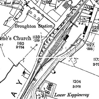 click to enlarge click to enlargeCSRY0117.jpg "Broughton Station / W.M. / Cattle Pens" |
|
|
|
||
| evidence:- | old map:- Garnett 1850s-60s H |
|
| source data:- | Map of the English Lakes, in Cumberland, Westmorland and
Lancashire, scale about 3.5 miles to 1 inch, published by John
Garnett, Windermere, Westmorland, 1850s-60s.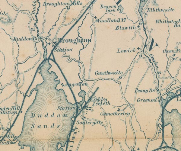 GAR2SD28.jpg "Station" no dot, triangular junction with Coniston Triple line, light bold light, railway shown. item:- JandMN : 82.1 Image © see bottom of page |
|
|
|
||
 Lakes Guides menu.