 Old Cumbria Gazetteer
 |
 |
|
| Burrow House, Cartmel Fell | ||
| Burrow House | ||
| civil parish:- | Cartmel Fell (formerly Lancashire) | |
| county:- | Cumbria | |
| locality type:- | buildings | |
| coordinates:- | SD38669103 | |
| 1Km square:- | SD3891 | |
| 10Km square:- | SD39 | |
|
|
||
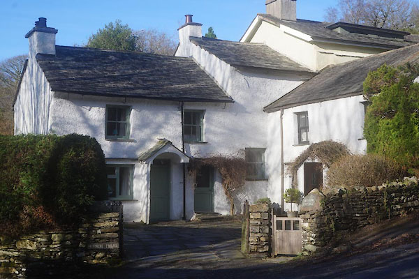 CEO28.jpg and Burrow Cottage on the right. (taken 10.2.2016) |
||
|
|
||
| evidence:- | old map:- OS County Series (Lan 8 3) placename:- Burrow House |
|
| source data:- | Maps, County Series maps of Great Britain, scales 6 and 25
inches to 1 mile, published by the Ordnance Survey, Southampton,
Hampshire, from about 1863 to 1948. |
|
|
|
||
 Lakes Guides menu.