 Old Cumbria Gazetteer
 |
 |
|
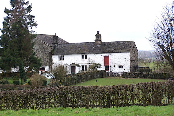
| Burton House, Skelsmergh | ||
| Burton House | ||
| Church View | ||
| locality:- | Stocks | |
| civil parish:- | Skelsmergh (formerly Westmorland) | |
| county:- | Cumbria | |
| locality type:- | buildings | |
| coordinates:- | SD52839643 | |
| 1Km square:- | SD5296 | |
| 10Km square:- | SD59 | |
|
|
||
 BLT05.jpg (taken 31.3.2006) |
||
|
|
||
| evidence:- | old map:- OS County Series (Wmd 33 12) placename:- Burton House |
|
| source data:- | Maps, County Series maps of Great Britain, scales 6 and 25
inches to 1 mile, published by the Ordnance Survey, Southampton,
Hampshire, from about 1863 to 1948. |
|
|
|
||
| evidence:- | database:- Listed Buildings 2010 placename:- Burton House |
|
| source data:- | courtesy of English Heritage "BURTON HOUSE AND ATTACHED BARN AND OUTBUILDING / / A6 / SKELSMERGH / SOUTH LAKELAND / CUMBRIA / II / 75748 / SD5283296438" |
|
|
|
||
 Lakes Guides menu.