 Old Cumbria Gazetteer
 |
 |
|
| Byers Pike, Midgeholme | ||
| Byers Pike | ||
| civil parish:- | Midgeholme (formerly Cumberland) | |
| county:- | Cumbria | |
| locality type:- | hill | |
| coordinates:- | NY63695730 | |
| 1Km square:- | NY6357 | |
| 10Km square:- | NY65 | |
| altitude:- | 1502 feet | |
| altitude:- | 458m | |
| county:- | Northumberland | |
| current boundary | ||
| locality:- | Cumbria boundary | |
| old boundary | ||
| locality:- | Cumberland boundary | |
|
|
||
| evidence:- | old map:- Donald 1774 (Cmd) placename:- Byers Pike |
|
| source data:- | Map, hand coloured engraving, 3x2 sheets, The County of Cumberland, scale about 1
inch to 1 mile, by Thomas Donald, engraved and published by Joseph Hodskinson, 29
Arundel Street, Strand, London, 1774.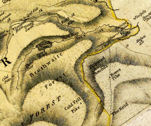 D4NY65NW.jpg "Byers Pike" hill hachuring; hill or mountain, and triangle symbol, on one of the county boundaries item:- Carlisle Library : Map 2 Image © Carlisle Library |
|
|
|
||
 Lakes Guides menu.