 Old Cumbria Gazetteer
 |
 |
|
| Carleton Hill, St Cuthbert Without | ||
| Carleton Hill | ||
| civil parish:- | St Cuthbert Without (formerly Cumberland) | |
| county:- | Cumbria | |
| locality type:- | buildings | |
| coordinates:- | NY45005011 | |
| 1Km square:- | NY4550 | |
| 10Km square:- | NY45 | |
|
|
||
 BQF37.jpg (taken 11.3.2009) |
||
|
|
||
| evidence:- | old map:- OS County Series (Cmd 31 1) placename:- Carleton Hill |
|
| source data:- | Maps, County Series maps of Great Britain, scales 6 and 25
inches to 1 mile, published by the Ordnance Survey, Southampton,
Hampshire, from about 1863 to 1948. |
|
|
|
||
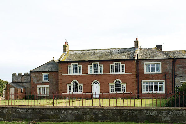
| evidence:- | database:- Listed Buildings 2010 placename:- Carleton Hill Farm |
|
| source data:- | courtesy of English Heritage "CARLETON HILL FARMHOUSE / / A6 / ST CUTHBERT WITHOUT / CARLISLE / CUMBRIA / II / 77618 / NY4499450118" |
|
|
|
||
| evidence:- | database:- Listed Buildings 2010 |
|
| source data:- | courtesy of English Heritage "GARDEN WALL AND GATE PIERS TO WEST OF CARLETON HILL / / A6 / ST CUTHBERT WITHOUT / CARLISLE / CUMBRIA / II / 77619 / NY4495450104" |
|
|
|
||
 Lakes Guides menu.