 Old Cumbria Gazetteer
 |
 |
|
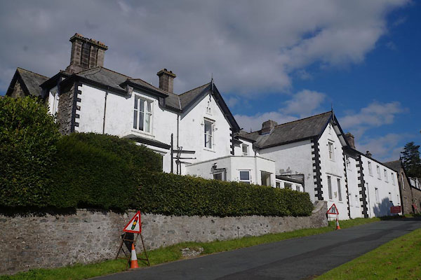
| Castlerigg Manor, Keswick | ||
| Castlerigg Manor | ||
| Street:- | Ambleside Road | |
| locality:- | Keswick | |
| civil parish:- | Keswick (formerly Cumberland) | |
| county:- | Cumbria | |
| locality type:- | buildings | |
| coordinates:- | NY27332308 | |
| 1Km square:- | NY2723 | |
| 10Km square:- | NY22 | |
|
|
||
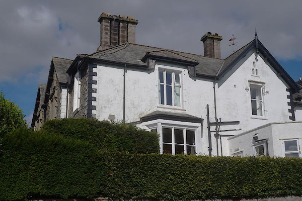 CDY17.jpg (taken 16.9.2015) 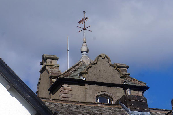 CDY18.jpg (taken 16.9.2015) |
||
| The 'front' is out of sight. |
||
|
|
||
| evidence:- | old map:- OS County Series (Cmd 64 6) placename:- Castlerigg House |
|
| source data:- | Maps, County Series maps of Great Britain, scales 6 and 25
inches to 1 mile, published by the Ordnance Survey, Southampton,
Hampshire, from about 1863 to 1948. |
|
|
|
||
| evidence:- | old map:- Ogilby 1675 (plate 96) placename:- Catherit |
|
| source data:- | Road strip map, hand coloured engraving, the Road from Kendal to
Cockermouth, and the Road from Egremond to Carlisle, scale about
1 inch to 1 mile, by John Ogilby, London, 1675.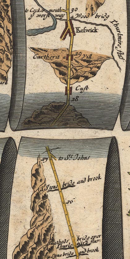 OG96m025.jpg In mile 28, Cumberland. "Cartherit a Vill" houses drawn each side of the road. item:- JandMN : 22 Image © see bottom of page |
|
|
|
||
| evidence:- | perhaps old map:- Bowen 1720 (plate 260) placename:- Cartherit |
|
| source data:- | Road strip map, uncoloured engraving, pl.260, The Road from
Kendal to Cockermouth, scale about 2 miles to 1 inch, with
sections in Westmorland and Cumberland, published by Emanuel
Bowen, St Katherines, London, 1720.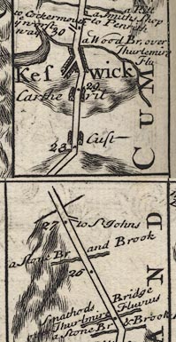 B260m25.jpg At mile 29. item:- private collection : 1.260 Image © see bottom of page |
|
|
|
||
| evidence:- | old map:- Bowen and Kitchin 1760 placename:- Cartheril |
|
| source data:- | Map, hand coloured engraving, A New Map of the Counties of
Cumberland and Westmoreland Divided into their Respective Wards,
scale about 4 miles to 1 inch, by Emanuel Bowen and Thomas
Kitchin et al, published by T Bowles, Robert Sayer, and John
Bowles, London, 1760.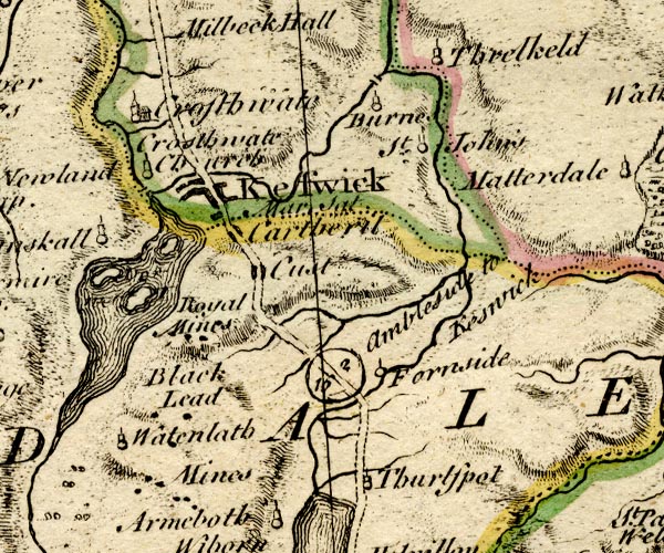 BO18NY21.jpg "Cartheril" blocks, on road item:- Armitt Library : 2008.14.10 Image © see bottom of page |
|
|
|
||
| evidence:- | database:- Listed Buildings 2010 placename:- Castlerigg Manor |
|
| source data:- | courtesy of English Heritage "CASTLERIGG MANOR (CATHOLIC YOUTH CENTRE) / / AMBLESIDE ROAD / KESWICK / ALLERDALE / CUMBRIA / II / 71763 / NY2733723083" |
|
|
|
||
| evidence:- | database:- Listed Buildings 2010 |
|
| source data:- | courtesy of English Heritage "BALUSTRADING, URNS, AND TERRACE WALL TO GARDEN ON NORTH SIDE OF CASTLERIGG MANOR / / AMBLESIDE ROAD / KESWICK / ALLERDALE / CUMBRIA / II / 71764 / NY2735723114" |
|
|
|
||
 CDY16.jpg (taken 16.9.2015) |
||
|
|
||
 Lakes Guides menu.