 Old Cumbria Gazetteer
 |
 |
|
| Castlesteads, Hesket | ||
| Castlesteads | ||
| locality:- | Plumpton | |
| civil parish:- | Hesket (formerly Cumberland) | |
| county:- | Cumbria | |
| locality type:- | buildings | |
| coordinates:- | NY49403834 | |
| 1Km square:- | NY4938 | |
| 10Km square:- | NY43 | |
|
|
||
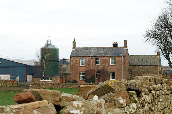 BQF32.jpg (taken 11.3.2009) |
||
|
|
||
| evidence:- | old map:- Garnett 1850s-60s H placename:- Plumpton Wall |
|
| source data:- | Map of the English Lakes, in Cumberland, Westmorland and
Lancashire, scale about 3.5 miles to 1 inch, published by John
Garnett, Windermere, Westmorland, 1850s-60s.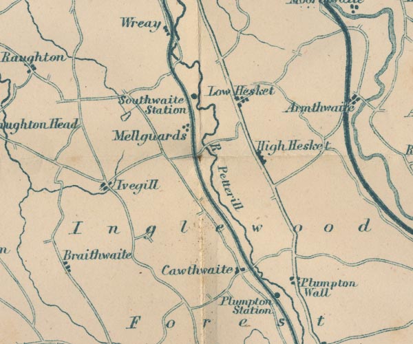 GAR2NY44.jpg "Plumpton Wall" blocks, settlement item:- JandMN : 82.1 Image © see bottom of page |
|
|
|
||
 Lakes Guides menu.