 Old Cumbria Gazetteer
 |
 |
|
| Cliburn Town Bridge, Cliburn | ||
| Cliburn Town Bridge | ||
| site name:- | Leith, River | |
| locality:- | Cliburn | |
| civil parish:- | Cliburn (formerly Westmorland) | |
| civil parish:- | Morland (formerly Westmorland) | |
| county:- | Cumbria | |
| locality type:- | bridge | |
| coordinates:- | NY58882440 | |
| 1Km square:- | NY5824 | |
| 10Km square:- | NY52 | |
|
|
||
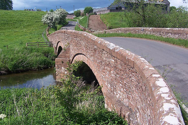 BMD34.jpg (taken 29.5.2006) |
||
|
|
||
| evidence:- | old map:- OS County Series (Wmd 8 7) placename:- Cliburn Town Bridge |
|
| source data:- | Maps, County Series maps of Great Britain, scales 6 and 25
inches to 1 mile, published by the Ordnance Survey, Southampton,
Hampshire, from about 1863 to 1948. |
|
|
|
||
| evidence:- | old map:- Bowen and Kitchin 1760 |
|
| source data:- | Map, hand coloured engraving, A New Map of the Counties of
Cumberland and Westmoreland Divided into their Respective Wards,
scale about 4 miles to 1 inch, by Emanuel Bowen and Thomas
Kitchin et al, published by T Bowles, Robert Sayer, and John
Bowles, London, 1760.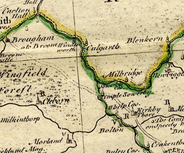 BO18NY52.jpg double line across the Leith ??? item:- Armitt Library : 2008.14.10 Image © see bottom of page |
|
|
|
||
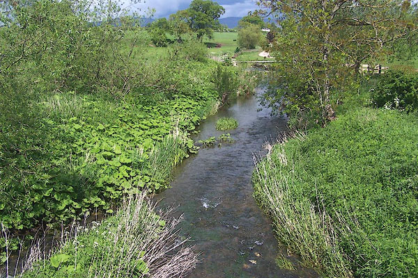 BMD36.jpg View of river. (taken 29.5.2006) |
||
|
|
||
 Lakes Guides menu.