 Old Cumbria Gazetteer
 |
 |
|
| Cloven Stone, Mungrisdale | ||
| Cloven Stone | ||
| locality:- | Mungrisdale Common | |
| civil parish:- | Mungrisdale (formerly Cumberland) | |
| civil parish:- | Threlkeld (formerly Cumberland) | |
| county:- | Cumbria | |
| locality type:- | stone | |
| locality type:- | boundary stone | |
| locality type:- | parish boundary mark | |
| coordinates:- | NY30332881 | |
| 1Km square:- | NY3028 | |
| 10Km square:- | NY32 | |
|
|
||
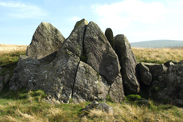 BPR43.jpg (taken 26.9.2008) 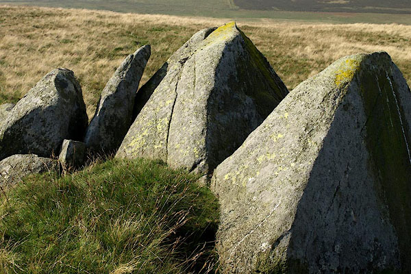 BPR44.jpg (taken 26.9.2008) |
||
|
|
||
| evidence:- | old map:- OS County Series (Cmd 56 8) placename:- Cloven Stone |
|
| source data:- | Maps, County Series maps of Great Britain, scales 6 and 25
inches to 1 mile, published by the Ordnance Survey, Southampton,
Hampshire, from about 1863 to 1948. |
|
|
|
||
| notes:- |
Note from Colin Smith, 2003 |
|
| Mungrisdale 00050 |
||
|
|
||
 Lakes Guides menu.