 Old Cumbria Gazetteer
 |
 |
|
| Crookelty Bridge, Underskiddaw | ||
| Crookelty Bridge | ||
| site name:- | Mill Beck (5) | |
| locality:- | Millbeck | |
| civil parish:- | Underskiddaw (formerly Cumberland) | |
| county:- | Cumbria | |
| locality type:- | bridge | |
| coordinates:- | NY25332584 | |
| 1Km square:- | NY2525 | |
| 10Km square:- | NY22 | |
|
|
||
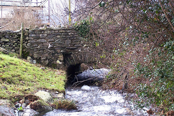 BLO23.jpg (taken 20.1.2006) |
||
|
|
||
| evidence:- | old map:- OS County Series (Cmd 56 13) placename:- Crookelty Bridge |
|
| source data:- | Maps, County Series maps of Great Britain, scales 6 and 25
inches to 1 mile, published by the Ordnance Survey, Southampton,
Hampshire, from about 1863 to 1948. |
|
|
|
||
| evidence:- | old map:- Ogilby 1675 (plate 96) |
|
| source data:- | Road strip map, hand coloured engraving, the Road from Kendal to
Cockermouth, and the Road from Egremond to Carlisle, scale about
1 inch to 1 mile, by John Ogilby, London, 1675.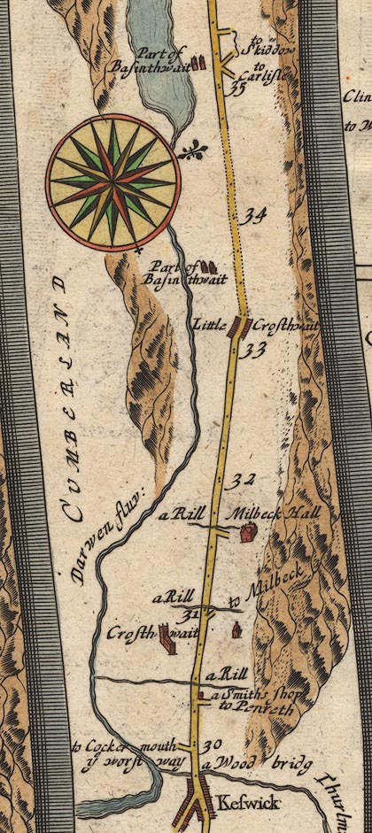 OG96m030.jpg In mile 31, Cumberland. "a Rill" drawn across the road, implying no bridge? item:- JandMN : 22 Image © see bottom of page |
|
|
|
||
| evidence:- | old map:- Bowen and Kitchin 1760 |
|
| source data:- | Map, hand coloured engraving, A New Map of the Counties of
Cumberland and Westmoreland Divided into their Respective Wards,
scale about 4 miles to 1 inch, by Emanuel Bowen and Thomas
Kitchin et al, published by T Bowles, Robert Sayer, and John
Bowles, London, 1760.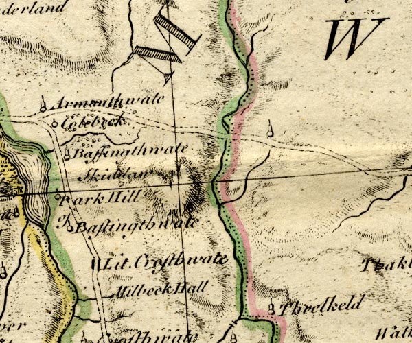 BO18NY22.jpg road across Mill Beck item:- Armitt Library : 2008.14.10 Image © see bottom of page |
|
|
|
||
| evidence:- | old map:- Bell 1892 placename:- Crookety Bridge |
|
| source data:- | Map, colour lithograph, Road Map of Cumberland, by George Joseph
Bell, scale about 2.5 miles to 1 inch, printed by Charles
Thurnam and Sons, Carlisle, Cumberland, 1892.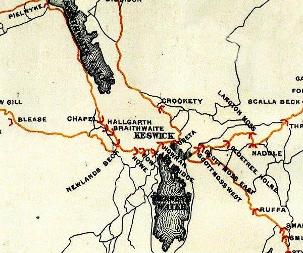 BEL9NY22.jpg "CROOKETY" bridge symbol Road map of Cumberland showing County Bridges item:- Carlisle Library : Map 38 Image © Carlisle Library |
|
|
|
||
 Lakes Guides menu.