 Old Cumbria Gazetteer
 |
 |
|
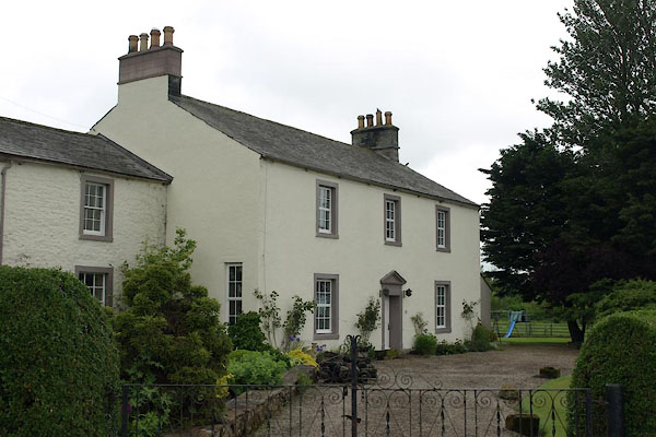
| Elephant, Hesket | ||
| Elephant | ||
| civil parish:- | Hesket (formerly Cumberland) | |
| county:- | Cumbria | |
| locality type:- | buildings | |
| coordinates:- | NY45354245 | |
| 1Km square:- | NY4542 | |
| 10Km square:- | NY44 | |
|
|
||
 BWR26.jpg (taken 8.6.2012) 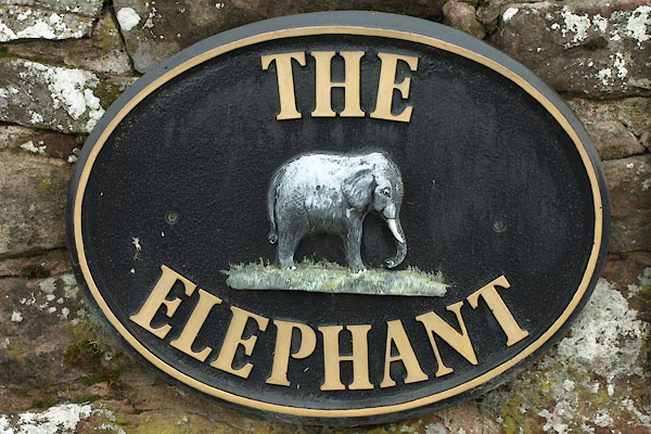 BWR27.jpg Sign. (taken 8.6.2012) |
||
|
|
||
| evidence:- | old map:- OS County Series (Cmd 39 6) placename:- Elephant Inn |
|
| source data:- | Maps, County Series maps of Great Britain, scales 6 and 25
inches to 1 mile, published by the Ordnance Survey, Southampton,
Hampshire, from about 1863 to 1948. to the W are "Mill Dam / Sluice" |
|
|
|
||
| evidence:- | database:- Listed Buildings 2010 placename:- Elephant, The |
|
| source data:- | courtesy of English Heritage "THE ELEPHANT / / / HESKET / EDEN / CUMBRIA / II / 73881 / NY4535942453" |
|
|
|
||
| hearsay:- |
Before there was a motorway, this farm stood by the side road from Penrith to Carlisle,
an alternative to the main road, now the A6. A travelling circus used this route in
preference to the busier road, and on one journey an elephant died and was buried
here. |
|
|
|
||
 Lakes Guides menu.