 Old Cumbria Gazetteer
 |
 |
|
| Ghyll Foot, Grasmere | ||
| Ghyll Foot | ||
| Gill Foot | ||
| locality:- | Grasmere | |
| civil parish:- | Lakes (formerly Westmorland) | |
| county:- | Cumbria | |
| locality type:- | buildings | |
| coordinates:- | NY33190954 | |
| 1Km square:- | NY3309 | |
| 10Km square:- | NY30 | |
|
|
||
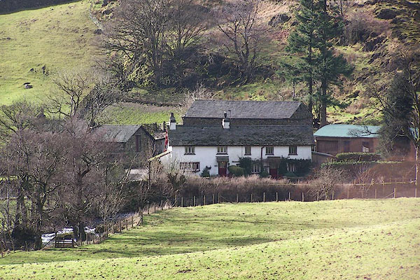 BLP89.jpg (taken 15.2.2006) |
||
|
|
||
| evidence:- | old map:- OS County Series (Wmd 18 12) placename:- Gill Foot |
|
| source data:- | Maps, County Series maps of Great Britain, scales 6 and 25
inches to 1 mile, published by the Ordnance Survey, Southampton,
Hampshire, from about 1863 to 1948. |
|
|
|
||
| evidence:- | old map:- Jefferys 1770 (Wmd) placename:- Gill Foot |
|
| source data:- | Map, 4 sheets, The County of Westmoreland, scale 1 inch to 1
mile, surveyed 1768, and engraved and published by Thomas
Jefferys, London, 1770.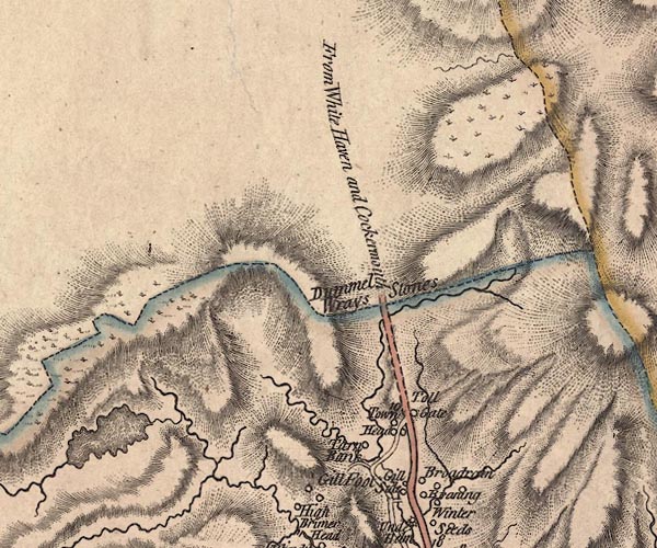 J5NY31SW.jpg "Gill Foot" circle, labelled in italic lowercase text; settlement, farm, house, or hamlet? item:- National Library of Scotland : EME.s.47 Image © National Library of Scotland |
|
|
|
||
| evidence:- | old map:- Clarke 1787 map (Ambleside to Keswick) placename:- Gillfoot |
|
| source data:- | Map, A Map of the Roads Lakes etc between Keswick and Ambleside,
scale about 2.5 ins to 1 mile, by James Clarke, engraved by S J
Neele, 352 Strand, published by James Clarke, Penrith,
Cumberland and in London etc, 1787.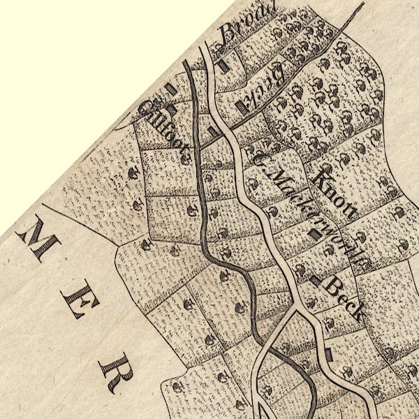 CL9NY30J.jpg "Gillfoot" item:- private collection : 10.9 Image © see bottom of page |
|
|
|
||
| evidence:- | database:- Listed Buildings 2010 placename:- Ghyll Foot |
|
| source data:- | courtesy of English Heritage "GHYLL FOOT / / / LAKES / SOUTH LAKELAND / CUMBRIA / II / 452092 / NY3320709553" |
|
|
|
||
 Lakes Guides menu.