 Old Cumbria Gazetteer
 |
 |
|
| Glencoyne, Patterdale | ||
| Glencoyne | ||
| Glencoynedale | ||
| civil parish:- | Patterdale (formerly Westmorland) | |
| civil parish:- | Matterdale (formerly Cumberland) | |
| county:- | Cumbria | |
| locality type:- | valley | |
| coordinates:- | NY379186 (etc) | |
| 1Km square:- | NY3718 | |
| 10Km square:- | NY31 | |
|
|
||
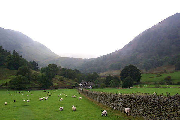 BJW76.jpg The far hills are missing in the cloud. (taken 30.9.2005) 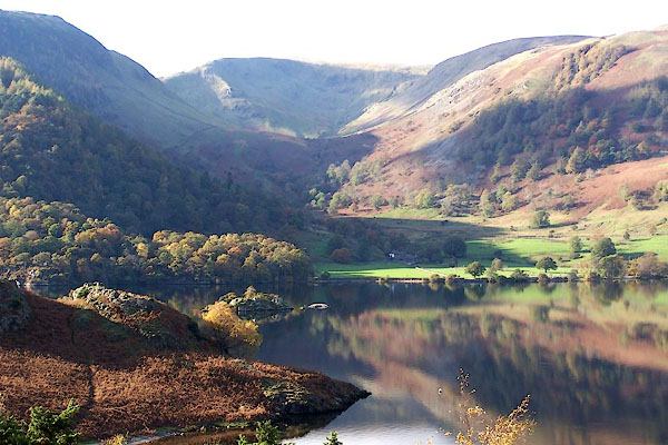 BMY20.jpg (taken 2.11.2006) |
||
|
|
||
| evidence:- | old text:- Clarke 1787 placename:- Glencoyn placename:- Glencune item:- land tenure; fishery |
|
| source data:- | Guide book, A Survey of the Lakes of Cumberland, Westmorland,
and Lancashire, written and published by James Clarke, Penrith,
Cumberland, and in London etc, 1787; published 1787-93. goto source goto sourcePage 30:- "..." "At the high end of Gowbarrow is Glencoyn, or Glencune, a beautiful retreat for the Summer, but a most dismal one during the Winter. The same rocky mountains covered with wood, which, when decked with the gay foliage of Summer, form a romantic picturesque hermitage, in the Winter exclude the direct rays of the sun during the whole months of November, December, and January." "Glencoyn consists of five customary tenements, held under the Earl of Surrey's manor of Deep-Dale, and pays about 3l. 4s. per annum fineable rent, a twenty-penny fine at the death of lord or tenant, and a thirty-penny fine upon an alienation. The wood is free, and so likewise is a fishery, which extends from Stibrah to Hell-Beck in the lower end of Gowbarrow, for which they pay to the Earl of Surrey an annual quit-rent of two merks." goto sourcePage 31:- "Glencoyn was formerly the estate of a family of Harrisons, one of whom going to London upon a law-suit, (then depending between him and the Lord of Graystock, for damage done by his deer,) was arrested there by his counsel and attorney for costs: he was thereupon obliged to sell his estate, which was bought by Mr William Graves, (master of an house in Lincoln's-Inn Fields famous for selling Burton ale,) for L.600. Graves lived to see it worth L.4000, and it is now in the possession of F. Hodgkinson, Esq; his son-in-law." |
|
|
|
||
| evidence:- | possibly old map:- Clarke 1787 map (Ullswater) |
|
| source data:- | Map, A Map of the Lake Ullswater and its Environs, scale about
6.5 ins to 1 mile, by James Clarke, engraved by S J Neele, 352
Strand, published by James Clarke, Penrith, Cumberland and in
London etc, 1787.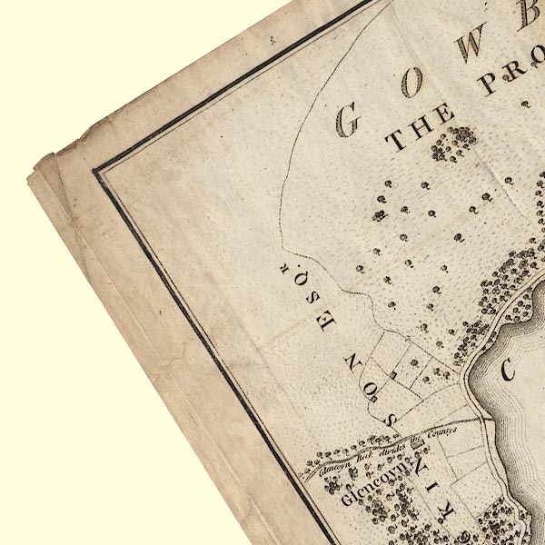 CL4NY31U.jpg "F. HODGKINSON ESQR." Labelled as the landowner of an area. item:- private collection : 10.4 Image © see bottom of page |
|
|
|
||
| evidence:- | old map:- Cary 1789 (edn 1805) placename:- Lancairn |
|
| source data:- | Map, uncoloured engraving, Westmoreland, scale about 2.5 miles
to 1 inch, by John Cary, London, 1789; edition 1805.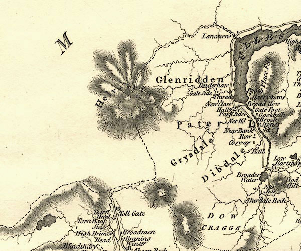 CY24NY31.jpg "Lancairn" block/s, labelled in italic lowercase; house, or hamlet item:- JandMN : 129 Image © see bottom of page |
|
|
|
||
| evidence:- | old print:- Green 1815 placename:- Glen Coin item:- cattle |
|
| source data:- | Print, coloured aquatint, Ulls Water from Glen Coin, Patterdale, Westmorland, by William
Green, Ambleside, Westmorland, 1815.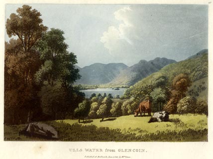 click to enlarge click to enlargeGN0518.jpg Plate 19 in Lake Scenery. printed at upper right:- "19" printed at bottom:- "ULLS WATER from GLEN COIN. / Published at Ambleside, June 1, 1815, by Wm. Green." item:- Armitt Library : A6646.18 Image © see bottom of page |
|
|
|
||
| evidence:- | old map:- Otley 1818 placename:- Glencoin |
|
| source data:- | Map, uncoloured engraving, The District of the Lakes,
Cumberland, Westmorland, and Lancashire, scale about 4 miles to
1 inch, by Jonathan Otley, 1818, engraved by J and G Menzies,
Edinburgh, Scotland, published by Jonathan Otley, Keswick,
Cumberland, et al, 1833.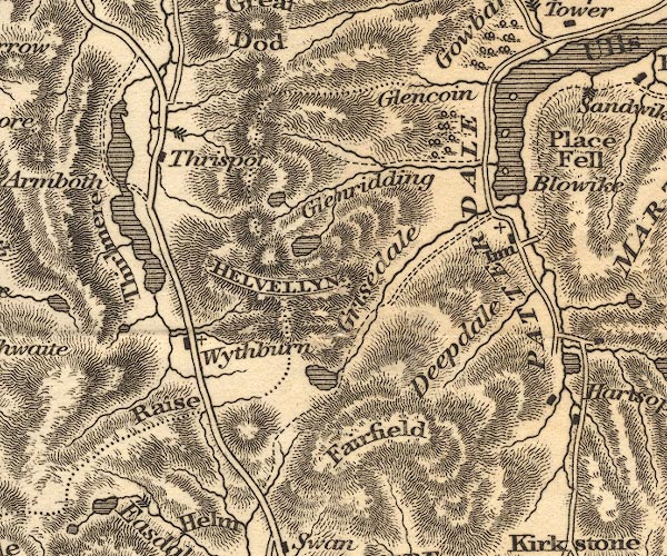 OT02NY31.jpg item:- JandMN : 48.1 Image © see bottom of page |
|
|
|
||
| evidence:- | old map:- Garnett 1850s-60s H placename:- Glencoin |
|
| source data:- | Map of the English Lakes, in Cumberland, Westmorland and
Lancashire, scale about 3.5 miles to 1 inch, published by John
Garnett, Windermere, Westmorland, 1850s-60s.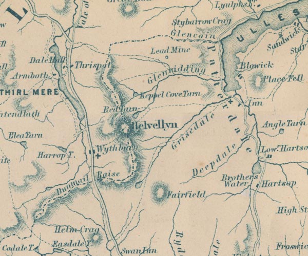 GAR2NY31.jpg "Glencoin" river valley item:- JandMN : 82.1 Image © see bottom of page |
|
|
|
||
| evidence:- | old text:- Martineau 1855 placename:- Glencoin item:- drawing |
|
| source data:- | Guide book, A Complete Guide to the English Lakes, by Harriet
Martineau, published by John Garnett, Windermere, Westmorland,
and by Whittaker and Co, London, 1855; published 1855-76. goto source Page 38:- "... Tales are told of artists who, turning into Glencoin, to find materials for a sketch, have not come out again for three months, finding themselves overwhelmed with tempting subjects for the pencil. The singularly primitive character of the popular mind in those secluded corners is almost as great an incitement to study as the variety and richness of the foregrounds and the colouring." |
|
|
|
||
| evidence:- | outline view:- Black 1856 (23rd edn 1900) placename:- Glen Coin |
|
| source data:- | Print, lithograph, Outline Views, Ullswater - Mountains as seen a little on the Matterdale
Road near Lyulph's Tower on Ullswater, and Mountains as seen at the Slate Quarry at
Blowick on Ullswater, by J Flintoft, Keswick, Cumberland, engraved by R Mason, Edinburgh,
Lothian, about 1900.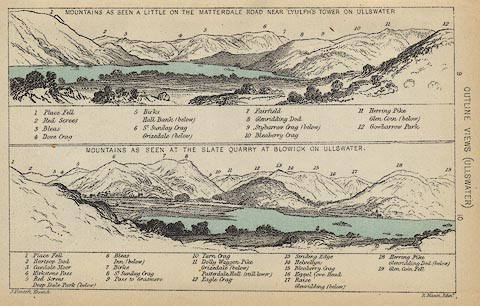 click to enlarge click to enlargeBC08E2.jpg "... Glen Coin ..." item:- JandMN : 37.8 Image © see bottom of page |
|
|
|
||
| evidence:- | outline view:- Black 1841 (3rd edn 1846) placename:- Glen Coin |
|
| source data:- | Print, engraving, outline view, Mountains as seen a little on the Matterdale Road
near Lyulph's Tower on Ulleswater, and Mountains as seen at the Slate Quarry at Blowick
on Ulleswater, by J Flintoft, Keswick, Cumberland, engraved by R Mason, Edinburgh,
Lothian, about 1846.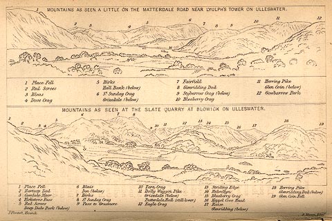 click to enlarge click to enlargeBC02E9.jpg "... Glen Coin ..." item:- JandMN : 32.15 Image © see bottom of page |
|
|
|
||
| evidence:- | outline view:- Tattersall 1836 placename:- Glencoin |
|
| source data:- | Print, engraving, Second Reach, Ullswater, from Place Fell, Westmorland, drawn by
George Tattersall, engraved by W F Topham, published by Sherwood and Co, Paternoster
Row, London, about 1836.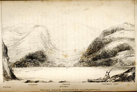 click to enlarge click to enlargeTAT141.jpg The print is captioned with mountain names and acts as an outline view. Tipped in opposite p.117 of The Lakes of England, by George Tattersall. printed at bottom:- "SECOND REACH, ULLSWATER; from PLACE FELL. / [London Pubd. ...]" printed at bottom left to right:- "Fairfield. / Stybarrow. / Helvellyn. / Glencoin. / Gowbarrow Parks." item:- Armitt Library : A1204.42 Image © see bottom of page |
|
|
|
||
 CED67.jpg (taken 20.10.2015)  Click to enlarge CED69.jpg Step from the lower to the upper part of the valley. (taken 20.10.2015) 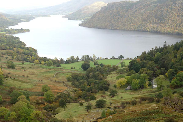 CED70.jpg The houses are Seldom Seen. (taken 20.10.2015) 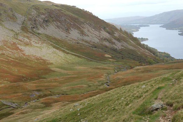 CED74.jpg (taken 20.10.2015) 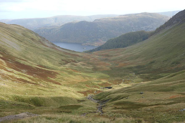 CED93.jpg near Glencoyne Head. (taken 20.10.2015) |
||
|
|
||
Lakes Guides menu.