 Old Cumbria Gazetteer
 |
 |
|
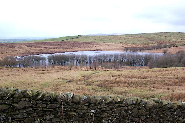
| Grayrigg Tarn, Grayrigg | ||
| runs into:- |  Grayrigg Hall Beck Grayrigg Hall Beck |
|
|
|
||
| Grayrigg Tarn | ||
| civil parish:- | Grayrigg (formerly Westmorland) | |
| county:- | Cumbria | |
| locality type:- | tarn | |
| coordinates:- | SD59599809 (etc) | |
| 1Km square:- | SD5998 | |
| 10Km square:- | SD59 | |
| altitude:- | 735 feet | |
| altitude:- | 224m | |
|
|
||
 BLT06.jpg (taken 31.3.2006) 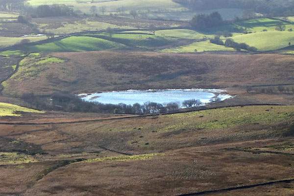 CGX25.jpg (taken 30.11.2017) |
||
|
|
||
| evidence:- | old map:- OS County Series (Wmd 34 7) placename:- Grayrigg Tarn |
|
| source data:- | Maps, County Series maps of Great Britain, scales 6 and 25
inches to 1 mile, published by the Ordnance Survey, Southampton,
Hampshire, from about 1863 to 1948. |
|
|
|
||
| evidence:- | old map:- Jefferys 1770 (Wmd) |
|
| source data:- | Map, 4 sheets, The County of Westmoreland, scale 1 inch to 1
mile, surveyed 1768, and engraved and published by Thomas
Jefferys, London, 1770.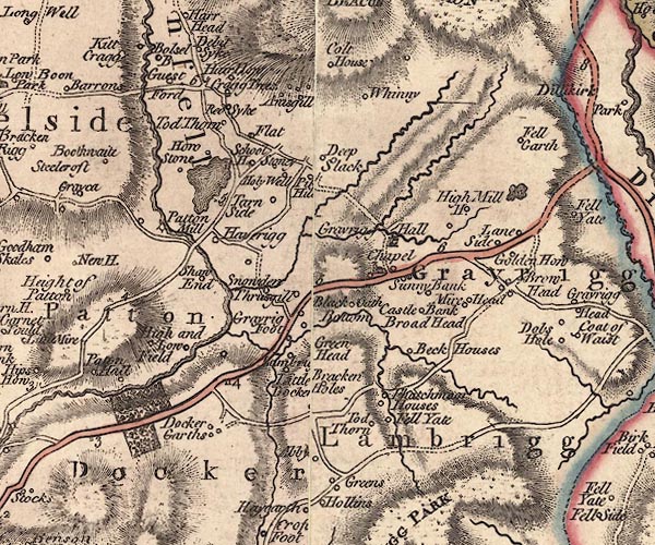 J5SD59NE.jpg outline with form lines; lake or tarn item:- National Library of Scotland : EME.s.47 Image © National Library of Scotland |
|
|
|
||
Lakes Guides menu.