Old Cumbria Gazetteer
 |
 |
|
||
| Great Langdale Beck | ||||
| runs into:- |  Elter Water Elter Water |
|||
|
|
||||
| civil parish:- | Lakes (formerly Westmorland) | |||
| county:- | Cumbria | |||
| locality type:- | river | |||
| 1Km square:- | NY3105 | |||
| 10Km square:- | NY30 | |||
|
|
||||
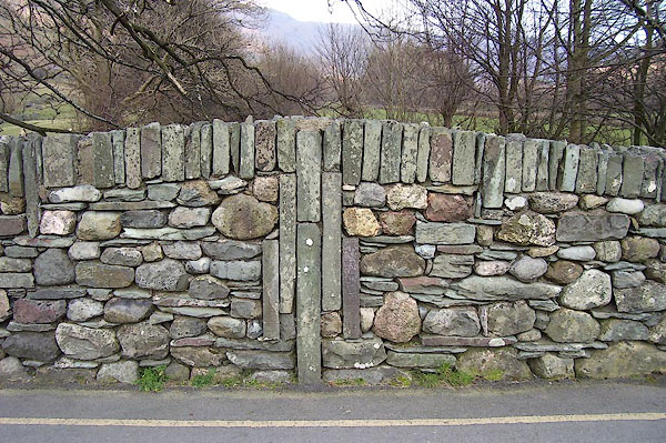
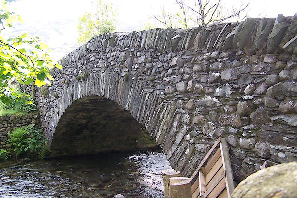
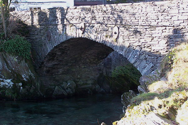
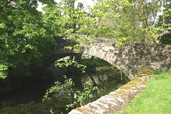
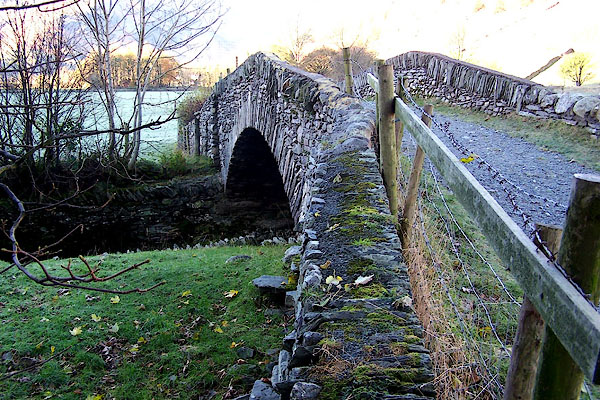
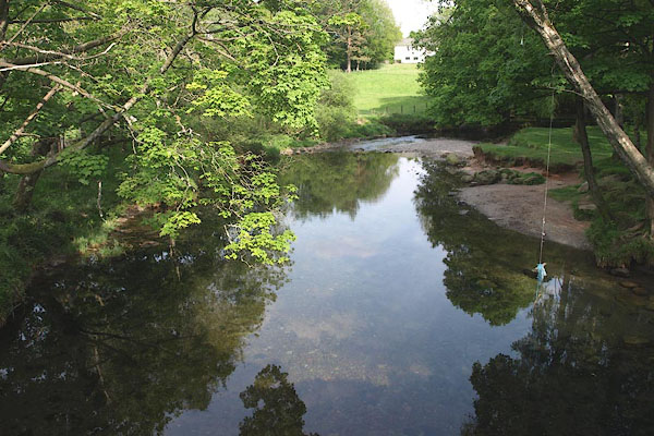 BPF34.jpg At New Bridge, Chapel Stile. (taken 20.5.2008)  BUP64.jpg (taken 19.5.2011) |
||||
|
|
||||
| evidence:- | old map:- OS County Series (Wmd 25 3) placename:- Great Langdale Beck placename:- Langdale Beck, Great |
|||
| source data:- | Maps, County Series maps of Great Britain, scales 6 and 25
inches to 1 mile, published by the Ordnance Survey, Southampton,
Hampshire, from about 1863 to 1948. OS County Series (Wmd 25 7) OS County Series (Wmd 25 8) |
|||
|
|
||||
| evidence:- | old map:- Saxton 1579 |
|||
| source data:- | Map, hand coloured engraving, Westmorlandiae et Cumberlandiae Comitatus ie Westmorland
and Cumberland, scale about 5 miles to 1 inch, by Christopher Saxton, London, engraved
by Augustinus Ryther, 1576, published 1579-1645.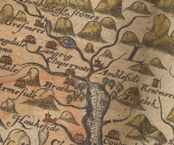 Sax9NY30.jpg item:- private collection : 2 Image © see bottom of page |
|||
|
|
||||
| evidence:- | old map:- Speed 1611 (Wmd) |
|||
| source data:- | Map, hand coloured engraving, The Countie Westmorland and
Kendale the Cheif Towne, scale about 2.5 miles to 1 inch, by
John Speed, 1610, published by George Humble, Popes Head Alley,
London, 1611-12.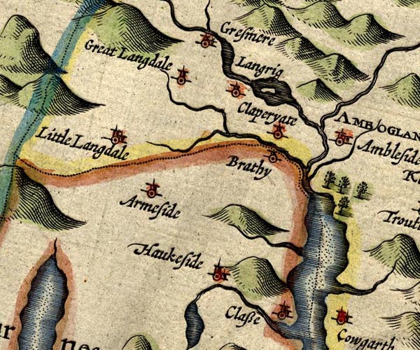 SP14NY30.jpg wiggly line, into the Brathay item:- Armitt Library : 2008.14.5 Image © see bottom of page |
|||
|
|
||||
| evidence:- | old map:- Jansson 1646 |
|||
| source data:- | Map, hand coloured engraving, Cumbria and Westmoria, ie
Cumberland and Westmorland, scale about 3.5 miles to 1 inch, by
John Jansson, Amsterdam, Netherlands, 1646.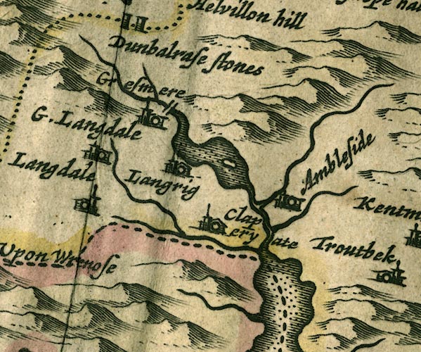 JAN3NY30.jpg Single wiggly line. item:- JandMN : 88 Image © see bottom of page |
|||
|
|
||||
| evidence:- | old map:- Morden 1695 (Wmd) |
|||
| source data:- | Map, hand coloured engraving, Westmorland, scale about 2.5 miles to 1 inch, by Robert
Morden, published by Abel Swale, the Unicorn, St Paul's Churchyard, Awnsham, and John
Churchill, the Black Swan, Paternoster Row, London, 1695.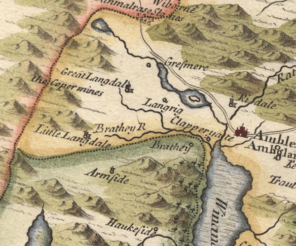 MD10NY30.jpg From Gt Langdale into Brathay. item:- JandMN : 24 Image © see bottom of page |
|||
|
|
||||
| evidence:- | old map:- Simpson 1746 map (Wmd) |
|||
| source data:- | Map, uncoloured engraving, Westmorland, scale about 8 miles to 1
inch, printed by R Walker, Fleet Lane, London, 1746.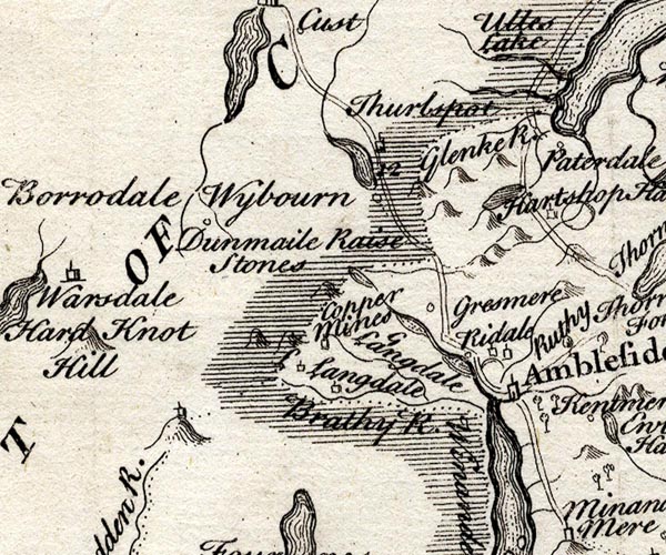 SMP2NYF.jpg Wiggly line. item:- Dove Cottage : 2007.38.59 Image © see bottom of page |
|||
|
|
||||
| evidence:- | old map:- Bowen and Kitchin 1760 |
|||
| source data:- | Map, hand coloured engraving, A New Map of the Counties of
Cumberland and Westmoreland Divided into their Respective Wards,
scale about 4 miles to 1 inch, by Emanuel Bowen and Thomas
Kitchin et al, published by T Bowles, Robert Sayer, and John
Bowles, London, 1760.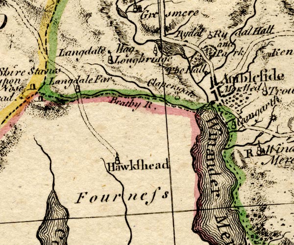 BO18SD29.jpg wiggly line, into the Brathay item:- Armitt Library : 2008.14.10 Image © see bottom of page |
|||
|
|
||||
| evidence:- | old map:- Jefferys 1770 (Wmd) |
|||
| source data:- | Map, 4 sheets, The County of Westmoreland, scale 1 inch to 1
mile, surveyed 1768, and engraved and published by Thomas
Jefferys, London, 1770.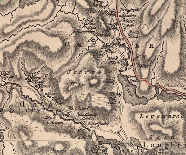 J5NY30NW.jpg single or double wiggly line; river item:- National Library of Scotland : EME.s.47 Image © National Library of Scotland |
|||
|
|
||||
| evidence:- | descriptive text:- West 1778 (11th edn 1821) |
|||
| source data:- | Guide book, A Guide to the Lakes, by Thomas West, published by
William Pennington, Kendal, Cumbria once Westmorland, and in
London, 1778 to 1821. goto source Rev Plumtre's Night Piece on Windermere, 1797 Page 230:- "..." "[the Brathay] ... / Tumbling, from rock to rock, his course, / With wild majestic, sullen force; /" goto sourcePage 231:- "Till to his sister's [1] arms he flies, /" "[1] The river Brathay is formed chiefly from two steams,- the one rising in Little Langdale, the other in Great Langdale, where it passes the Pikes and the slate quarry: these join in the small lake of Elter-water. ..." |
|||
|
|
||||
| evidence:- | old map:- West 1784 map |
|||
| source data:- | Map, hand coloured engraving, A Map of the Lakes in Cumberland,
Westmorland and Lancashire, scale about 3.5 miles to 1 inch,
engraved by Paas, 53 Holborn, London, about 1784.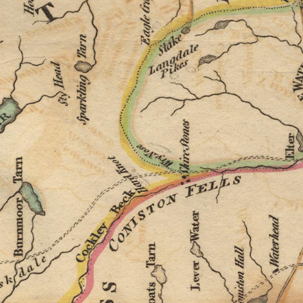 Ws02NY20.jpg 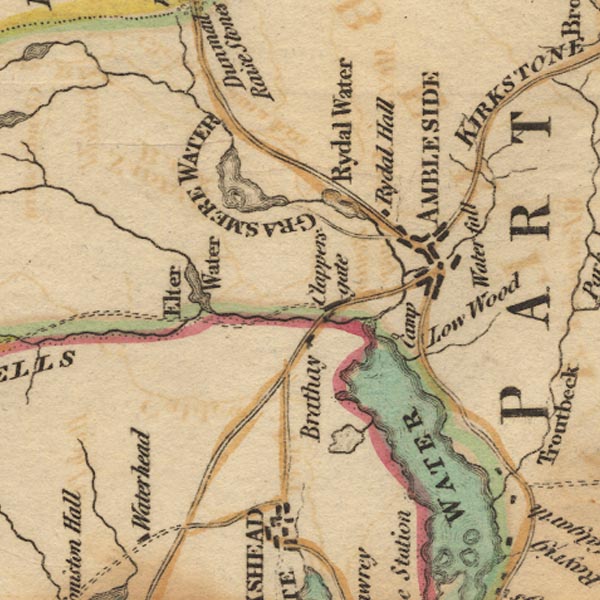 Ws02NY30.jpg item:- Armitt Library : A1221.1 Image © see bottom of page |
|||
|
|
||||
| evidence:- | old map:- Cary 1789 (edn 1805) |
|||
| source data:- | Map, uncoloured engraving, Westmoreland, scale about 2.5 miles
to 1 inch, by John Cary, London, 1789; edition 1805.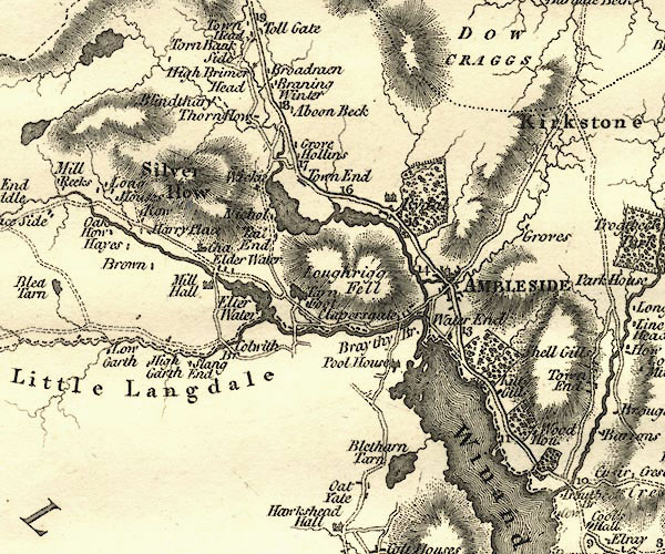 CY24NY30.jpg river running into Elter Water item:- JandMN : 129 Image © see bottom of page |
|||
|
|
||||
| evidence:- | old print:- Green 1814 (plate 16) item:- fishing |
|||
| source data:- | Print, uncoloured soft ground etching, Scene near Langdale Chapel, by Great Langdale
Beck, Westmorland, by William Green, Ambleside, Westmorland, 1814.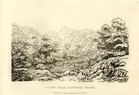 click to enlarge click to enlargeGN0916.jpg Plate 16 in Sixty Small Prints. printed at top right:- "16" printed at bottom:- "SCENE NEAR LANGDALE CHAPEL. / Published at Ambleside Augst. 1, 1814, by Wm. Green." item:- Armitt Library : A6656.16 Image © see bottom of page |
|||
|
|
||||
| evidence:- | old print:- Green 1814 (plate 16) item:- fishing |
|||
| source data:- | Print, tinted soft ground etching, Scene near Langdale Chapel, by Great Langdale Beck,
Westmorland, by William Green, Ambleside, Westmorland, 1814.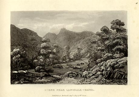 click to enlarge click to enlargeGN1016.jpg Plate 16 in Sixty Small Prints. printed at top right:- "16" printed at bottom:- "SCENE NEAR LANGDALE CHAPEL. / Published at Ambleside Augst. 1, 1814, by Wm. Green." item:- Armitt Library : A6653.16 Image © see bottom of page |
|||
|
|
||||
| evidence:- | old photograph:- Bell 1880s-1940s |
|||
| source data:- | Photograph, sepia, Great Langdale Beck, Langdale, Westmorland, by Herbert Bell, photographer,
Ambleside, Westmorland, 1890s.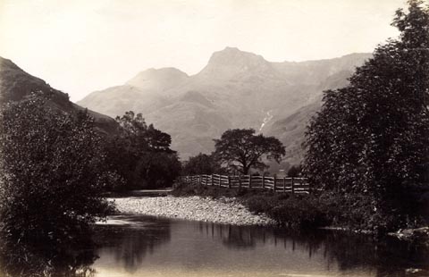 click to enlarge click to enlargeHB0880.jpg item:- Armitt Library : ALPS551 Image © see bottom of page |
|||
|
|
||||
| evidence:- | probably old print:- Green 1809 item:- footbridge |
|||
| source data:- | Print, soft ground etching, Wooden Bridge in Langdale, Westmorland, by William Green,
published by William Green, Ambleside, Westmorland, and Longman, Hurst, Rees and Orme,
Paternoster Row, London, 1809.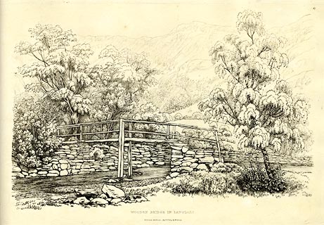 click to enlarge click to enlargeGN0367.jpg Plate 67 in Seventy Eight Studies from Nature. printed in introductory pages to set of prints:- "Number 67. This Wooden Bridge is over the principal stream flowing through Great Langdale; Loggan House, (the 35th of this series of prints) is seen beyond the bridge on the margin of the mountain." printed at bottom:- "WOODEN BRIDGE AT LANGDALE. / Published Ambleside, Augst. 1st. 1809, by W. Green." item:- Armitt Library : A6637.67 Image © see bottom of page |
|||
|
|
||||
| places:- |
|
|||
|
||||
|
||||
|
||||
|
||||
|
||||
|
||||
Lakes Guides menu.