 Old Cumbria Gazetteer
 |
 |
|
| Harker Station, Rockcliffe | ||
| Harker Station | ||
| site name:- | Border Union Railway | |
| locality:- | Low Harker | |
| civil parish:- | Rockcliffe (formerly Cumberland) | |
| county:- | Cumbria | |
| locality type:- | railway station (ex) | |
| coordinates:- | NY38636097 | |
| 1Km square:- | NY3860 | |
| 10Km square:- | NY36 | |
| SummaryText:- | Opened 1861; closed1929. | |
|
|
||
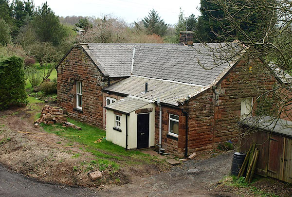 BQJ39.jpg (taken 11.4.2009) 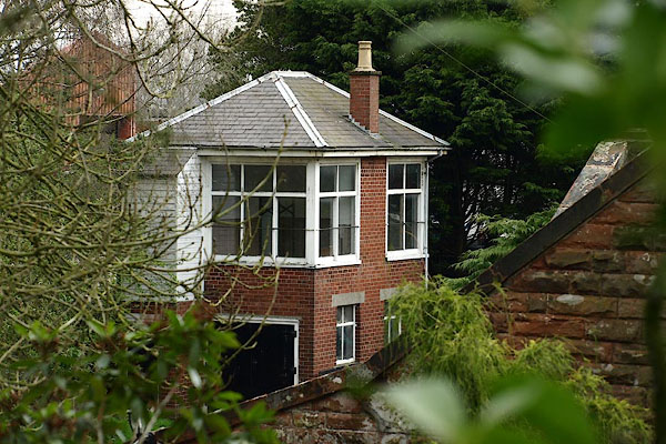 BQJ40.jpg Signal box. (taken 11.4.2009) |
||
|
|
||
| evidence:- | old map:- OS County Series (Cmd 16 7) placename:- Harker Station item:- railway bridge; railway signal; railway milepost |
|
| source data:- | Maps, County Series maps of Great Britain, scales 6 and 25
inches to 1 mile, published by the Ordnance Survey, Southampton,
Hampshire, from about 1863 to 1948.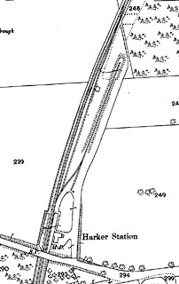 click to enlarge click to enlargeCSRY0039.jpg "Harker Station / M.P. / S.P." |
|
|
|
||
 Lakes Guides menu.