 Old Cumbria Gazetteer
 |
 |
|
| Hartside Height, Glassonby | ||
| Hartside Height | ||
| locality:- | Gilderdale Forest (?) | |
| civil parish:- | Glassonby (formerly Cumberland) | |
| civil parish:- | Alston Moor (formerly Cumberland) | |
| civil parish:- | Kirkoswald (formerly Cumberland) | |
| county:- | Cumbria | |
| locality type:- | hill | |
| locality type:- | boundary feature | |
| locality type:- | parish boundary feature | |
| coordinates:- | NY65104267 (etc) | |
| 1Km square:- | NY6542 | |
| 10Km square:- | NY64 | |
| altitude:- | 2046 feet | |
| altitude:- | 624m | |
|
|
||
| evidence:- | old map:- OS County Series (Cmd 41 2) placename:- Hartside Height |
|
| source data:- | Maps, County Series maps of Great Britain, scales 6 and 25
inches to 1 mile, published by the Ordnance Survey, Southampton,
Hampshire, from about 1863 to 1948. |
|
|
|
||
| evidence:- | old map:- Donald 1774 (Cmd) placename:- Hartside Fell |
|
| source data:- | Map, hand coloured engraving, 3x2 sheets, The County of Cumberland, scale about 1
inch to 1 mile, by Thomas Donald, engraved and published by Joseph Hodskinson, 29
Arundel Street, Strand, London, 1774.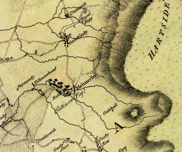 D4NY63NW.jpg 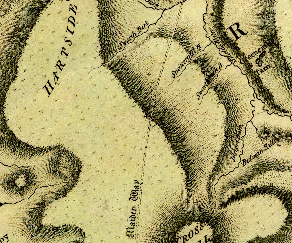 D4NY63NE.jpg 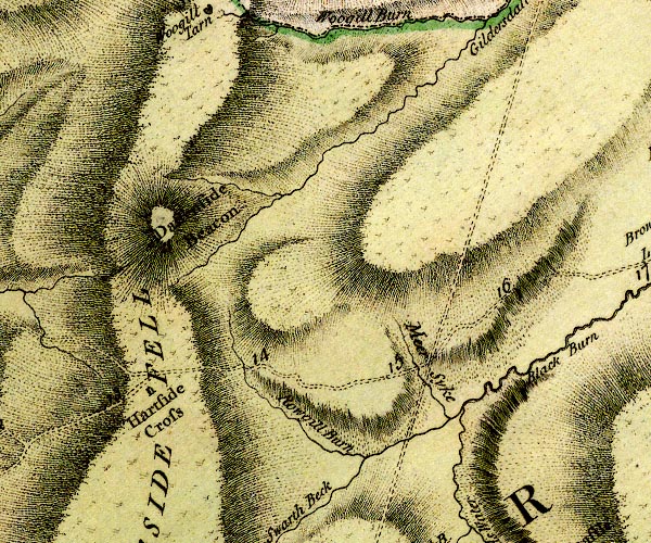 D4NY64SE.jpg "HARTSIDE FELL" hill hachuring; a hill or mountain item:- Carlisle Library : Map 2 Images © Carlisle Library |
|
|
|
||
 Lakes Guides menu.