 Old Cumbria Gazetteer
 |
 |
|
| Hawksdale Bridge, Hawksdale | ||
| Hawksdale Bridge | ||
| site name:- | Caldew, River | |
| locality:- | Bridge End | |
| civil parish:- | Dalston (formerly Cumberland) | |
| county:- | Cumbria | |
| locality type:- | bridge | |
| coordinates:- | NY37074880 | |
| 1Km square:- | NY3748 | |
| 10Km square:- | NY34 | |
|
|
||
| MN photo:- |
A plaque on the parapet:- |
|
| "HAWKSDALE BRIDGE RESTORED 1891" |
||
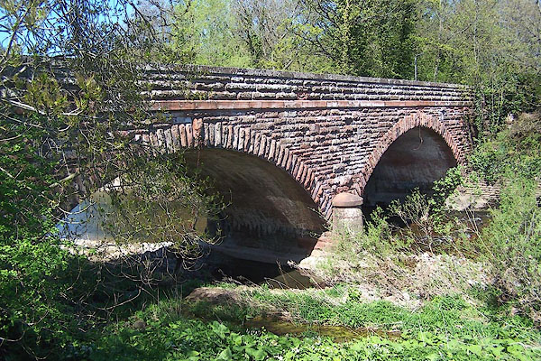 BMA55.jpg (taken 5.5.2006) |
||
|
|
||
| evidence:- | old map:- OS County Series (Cmd 30 6) placename:- Hawkesdale Bridge |
|
| source data:- | Maps, County Series maps of Great Britain, scales 6 and 25
inches to 1 mile, published by the Ordnance Survey, Southampton,
Hampshire, from about 1863 to 1948. |
|
|
|
||
| evidence:- | old map:- Donald 1774 (Cmd) |
|
| source data:- | Map, hand coloured engraving, 3x2 sheets, The County of Cumberland, scale about 1
inch to 1 mile, by Thomas Donald, engraved and published by Joseph Hodskinson, 29
Arundel Street, Strand, London, 1774.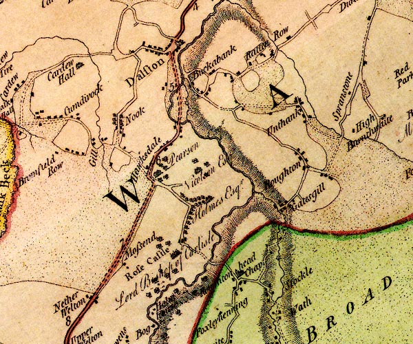 D4NY34NE.jpg double line across a river; a bridge item:- Carlisle Library : Map 2 Image © Carlisle Library |
|
|
|
||
 Lakes Guides menu.