 Old Cumbria Gazetteer
 |
 |
|
| High Cup Nick, Dufton | ||
| High Cup Nick | ||
| site name:- | Whin Sill | |
| locality:- | High Cup | |
| civil parish:- | Dufton (formerly Westmorland) | |
| civil parish:- | Murton (formerly Westmorland) | |
| county:- | Cumbria | |
| locality type:- | pass | |
| coordinates:- | NY74442620 (?) | |
| 1Km square:- | NY7426 | |
| 10Km square:- | NY72 | |
|
|
||
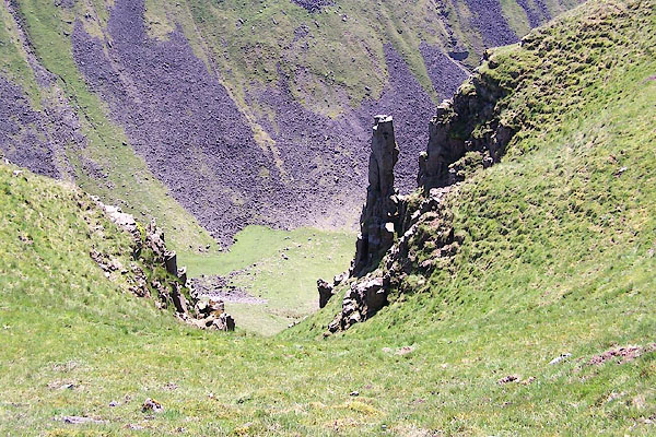 BQR94.jpg (taken 1.6.2009) 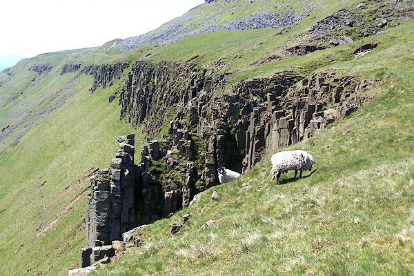 BQR95.jpg (taken 1.6.2009) |
||
|
|
||
| evidence:- | old map:- OS County Series (Wmd 10 1) placename:- High Cup Nick |
|
| source data:- | Maps, County Series maps of Great Britain, scales 6 and 25
inches to 1 mile, published by the Ordnance Survey, Southampton,
Hampshire, from about 1863 to 1948. |
|
|
|
||
| evidence:- | old map:- Jefferys 1770 (Wmd) |
|
| source data:- | Map, 4 sheets, The County of Westmoreland, scale 1 inch to 1
mile, surveyed 1768, and engraved and published by Thomas
Jefferys, London, 1770.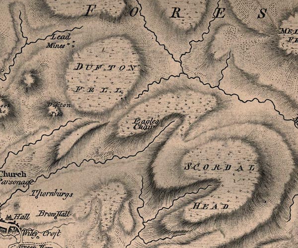 J5NY72NW.jpg hill hachuring; valley item:- National Library of Scotland : EME.s.47 Image © National Library of Scotland |
|
|
|
||
| observation:- |
This is the nick itself; the placename gets used wrongly for the whole area of High
Cupgill Head. |
|
|
|
||
 Lakes Guides menu.