 Old Cumbria Gazetteer
 |
 |
|
| islands, Bassenthwaite Lake | ||
| civil parish:- | Underskiddaw (formerly Cumberland) | |
| county:- | Cumbria | |
| locality type:- | island | |
| 1Km square:- | NY2226 | |
| 10Km square:- | NY22 | |
| SummaryText:- | There are no islands here on the current 1:25000 map. | |
| references:- | Crosthwaite 1783-94 |
|
|
|
||
| evidence:- | old map:- Crosthwaite 1783-94 (Bas) |
|
| source data:- | Map, uncoloured engraving, An Accurate Map of Broadwater or
Bassenthwaite Lake, scale about 3 inches to 1 mile, by Peter
Crosthwaite, Keswick, Cumberland, 1783, version published 1800.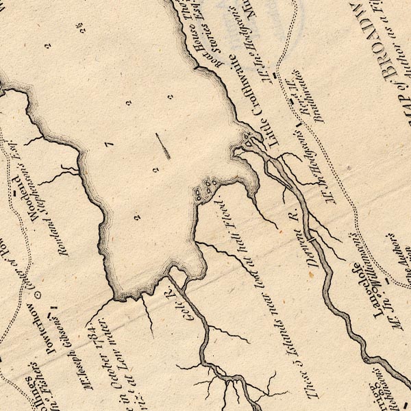 CT6NY22I.jpg "These 5 Islands near lost at half Flood" "NB: the Author Surveyed this Lake in October 1784, after Six Weeks of Fair Weather vizt. at Low water." 5 islands shown. item:- Armitt Library : 1959.191.4 Image © see bottom of page |
|
|
|
||
 Lakes Guides menu.