 Old Cumbria Gazetteer
 |
 |
|
| Knott, Caldbeck | ||
| Knott | ||
| civil parish:- | Caldbeck (formerly Cumberland) | |
| county:- | Cumbria | |
| locality type:- | hill | |
| coordinates:- | NY29613298 (etc) | |
| 1Km square:- | NY2932 | |
| 10Km square:- | NY23 | |
| altitude:- | 2329 feet | |
| altitude:- | 710m | |
|
|
||
| evidence:- | old map:- OS County Series (Cmd 47 15) placename:- Knott |
|
| source data:- | Maps, County Series maps of Great Britain, scales 6 and 25
inches to 1 mile, published by the Ordnance Survey, Southampton,
Hampshire, from about 1863 to 1948. |
|
|
|
||
| evidence:- | old map:- Gents Mag 1747 placename:- Knot Mountain |
|
| source data:- | Map, uncoloured engraving, perspective view, Caudbeck Fells ie
Caldbeck Fells, scale about 1+ miles to 1 inch, published in the
Gentleman's Magazine, 1747.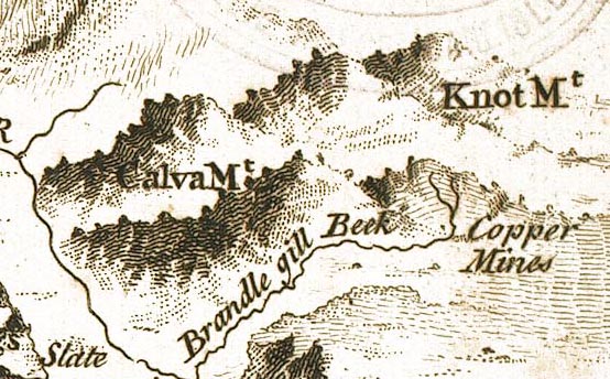 GM1407.jpg "Knot Mt" knobbly hillocks; mountains item:- Carlisle Library : Map 43 Image © Carlisle Library |
|
|
|
||
 Lakes Guides menu.