 Old Cumbria Gazetteer
 |
 |
|
| Liddel Tower, Nicholforest | ||
| Liddel Tower | ||
| locality:- | Liddel | |
| civil parish:- | Nicholforest (formerly Cumberland) | |
| county:- | Cumbria | |
| locality type:- | buildings | |
| coordinates:- | NY47757877 | |
| 1Km square:- | NY4778 | |
| 10Km square:- | NY47 | |
|
|
||
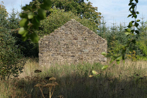 BZK04.jpg (taken 27.9.2013) |
||
| All you can see from the road. This may be a building that was on the N of the tower. |
||
|
|
||
| evidence:- | old map:- OS County Series (Cmd 3 10) placename:- Liddel Tower |
|
| source data:- | Maps, County Series maps of Great Britain, scales 6 and 25
inches to 1 mile, published by the Ordnance Survey, Southampton,
Hampshire, from about 1863 to 1948. |
|
|
|
||
| notes:- |
probable windmill or a folly |
|
| Perriam, D R &Robinson, J: 1998: Medieval Fortified Buildings of Cumbria: CWAAS::
ISBN 1 873124 23 6; illustration |
||
|
|
||
 Lakes Guides menu.