 Old Cumbria Gazetteer
 |
 |
|
| milestone, New Hutton | ||
| site name:- | road, Kendal to Sedbergh | |
| civil parish:- | New Hutton (formerly Westmorland) | |
| county:- | Cumbria | |
| locality type:- | milestone | |
| coordinates:- | SD56309218 | |
| 1Km square:- | SD5692 | |
| 10Km square:- | SD59 | |
|
|
||
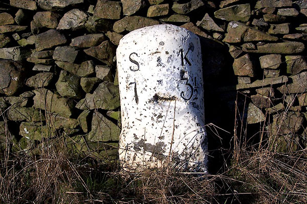 BLQ93.jpg Inscribed stone:- "S 7 / K 3½" (taken 4.3.2006) |
||
|
|
||
| evidence:- | old map:- OS County Series (Wmd 39 6) |
|
| source data:- | Maps, County Series maps of Great Britain, scales 6 and 25
inches to 1 mile, published by the Ordnance Survey, Southampton,
Hampshire, from about 1863 to 1948. "Kendal .. 3 1/2 Sedbergh .. 7 M.S." |
|
|
|
||
 Lakes Guides menu.