 Old Cumbria Gazetteer
 |
 |
|
| milestone, Kirkby Lonsdale | ||
| site name:- | road, Kendal to Kirkby Lonsdale | |
| civil parish:- | Kirkby Lonsdale (formerly Westmorland) | |
| county:- | Cumbria | |
| locality type:- | milestone | |
| coordinates:- | SD58417983 | |
| 1Km square:- | SD5879 | |
| 10Km square:- | SD57 | |
|
|
||
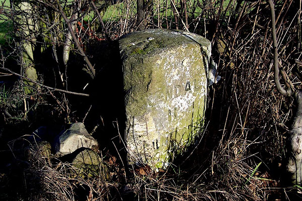 BLL80.jpg Stone inscribed:- "KIRKBY LONSDALE 2 / KENDAL 11 MILNTHORPE 7½" and a rivet bench mark on top. (taken 16.12.2005) |
||
|
|
||
| evidence:- | old map:- OS County Series (Wmd 47 7) |
|
| source data:- | Maps, County Series maps of Great Britain, scales 6 and 25
inches to 1 mile, published by the Ordnance Survey, Southampton,
Hampshire, from about 1863 to 1948. "M.S Kirkby Lonsdale .. 2 Kendal .. 11 Milnthorpe .. 7 1/2" |
|
|
|
||
| evidence:- | database:- Listed Buildings 2010 |
|
| source data:- | courtesy of English Heritage "MILESTONE APPROXIMATELY 650 YARDS NORTH WEST OF TEARNSIDE HALL / / KENDAL ROAD / KIRKBY LONSDALE / SOUTH LAKELAND / CUMBRIA / II / 75165 / SD5841879827" |
|
| source data:- | courtesy of English Heritage "C19. Triangular. Inscribed "Kirkby Lonsdale 2/Kendal 11/Milnthorpe 7 1/2"." |
|
|
|
||
 Lakes Guides menu.