 Old Cumbria Gazetteer
 |
 |
|
| milestone, Middleton | ||
| site name:- | road, Kirkby Lonsdale to Sedbergh | |
| civil parish:- | Middleton (formerly Westmorland) | |
| county:- | Cumbria | |
| locality type:- | milestone | |
| coordinates:- | SD62098480 | |
| 1Km square:- | SD6284 | |
| 10Km square:- | SD68 | |
|
|
||
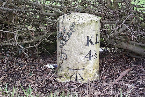 BLT48.jpg Inscribed stone:- "S 6 / K.L 4¾" (taken 31.3.2006) |
||
|
|
||
| evidence:- | old map:- OS County Series (Wmd 43 12) |
|
| source data:- | Maps, County Series maps of Great Britain, scales 6 and 25
inches to 1 mile, published by the Ordnance Survey, Southampton,
Hampshire, from about 1863 to 1948. "M.S. Kirkby Lonsdale .. 4 3/4 Sedbergh .. 6" |
|
|
|
||
| evidence:- | database:- Listed Buildings 2010 |
|
| source data:- | courtesy of English Heritage "MILESTONE APPROXIMATELY 200 METRES NORTH OF SORROWSDYKE LANE / / A683 / MIDDLETON / SOUTH LAKELAND / CUMBRIA / II / 75736 / SD6208984809" |
|
| source data:- | courtesy of English Heritage "Milestone. Probably early C19. Painted stone. Semi-circular on plan, on square base with broaches. Inscribed: "S:K.L./6:43/4". Benchmark above base. Set on Sedbergh to Greta Bridge turnpike road, 1762. (S = Sedbergh; KL = KIrkby Lonsdale)." |
|
|
|
||
 Lakes Guides menu.