 Old Cumbria Gazetteer
 |
 |
|
| Rutter Mill, Ormside | ||
| Rutter Mill | ||
| site name:- | Hoff Beck | |
| locality:- | Rutter | |
| civil parish:- | Ormside (formerly Westmorland) | |
| county:- | Cumbria | |
| locality type:- | mill | |
| locality type:- | water mill | |
| locality type:- | bobbin mill | |
| locality type:- | locality | |
| coordinates:- | NY68181581 | |
| 1Km square:- | NY6815 | |
| 10Km square:- | NY61 | |
|
|
||
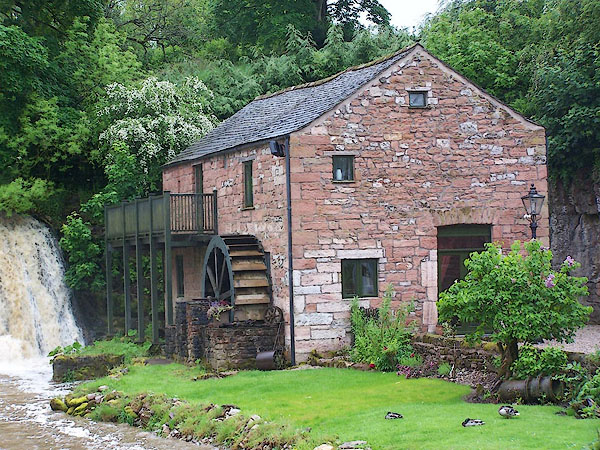 BJM95.jpg Back shot water wheel. (taken 5.6.2005) |
||
|
|
||
| evidence:- | old map:- OS County Series (Wmd 15 11) placename:- Rutter Mill |
|
| source data:- | Maps, County Series maps of Great Britain, scales 6 and 25
inches to 1 mile, published by the Ordnance Survey, Southampton,
Hampshire, from about 1863 to 1948. "Rutter Mill / Saw & Bobbin" |
|
|
|
||
| evidence:- | old map:- Jefferys 1770 (Wmd) placename:- Ruller Mills |
|
| source data:- | Map, 4 sheets, The County of Westmoreland, scale 1 inch to 1
mile, surveyed 1768, and engraved and published by Thomas
Jefferys, London, 1770.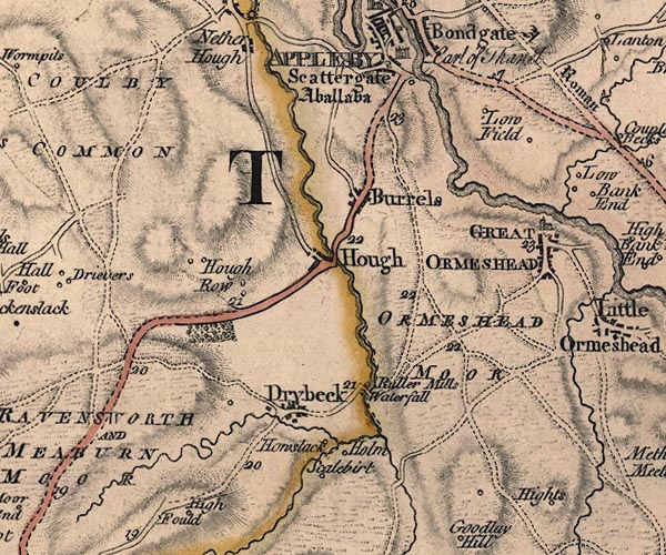 J5NY61NE.jpg "Ruller Mills" circle, labelled in italic lowercase text; settlement, farm, house, or hamlet?, mill item:- National Library of Scotland : EME.s.47 Image © National Library of Scotland |
|
|
|
||
| hearsay:- |
The mill was once used by the Great Asby Electric Light Co to generate power for Great
Asby village. |
|
|
|
||
 Lakes Guides menu.