 Old Cumbria Gazetteer
 |
 |
|
| Millrigg Bridge, Culgaith | ||
| Millrigg Bridge | ||
| site name:- | Crowdundle Beck | |
| locality:- | Millrigg | |
| civil parish:- | Culgaith (formerly Cumberland) | |
| civil parish:- | Temple Sowerby (formerly Westmorland) | |
| county:- | Cumbria | |
| locality type:- | bridge | |
| coordinates:- | NY60822820 | |
| 1Km square:- | NY6028 | |
| 10Km square:- | NY62 | |
|
|
||
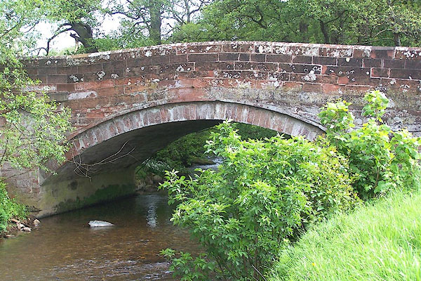 BME83.jpg (taken 1.6.2006) |
||
|
|
||
| evidence:- | old map:- OS County Series (Wmd 4 16) placename:- Millrigg Bridge |
|
| source data:- | Maps, County Series maps of Great Britain, scales 6 and 25
inches to 1 mile, published by the Ordnance Survey, Southampton,
Hampshire, from about 1863 to 1948. |
|
|
|
||
| evidence:- | old map:- Jefferys 1770 (Wmd) |
|
| source data:- | Map, 4 sheets, The County of Westmoreland, scale 1 inch to 1
mile, surveyed 1768, and engraved and published by Thomas
Jefferys, London, 1770.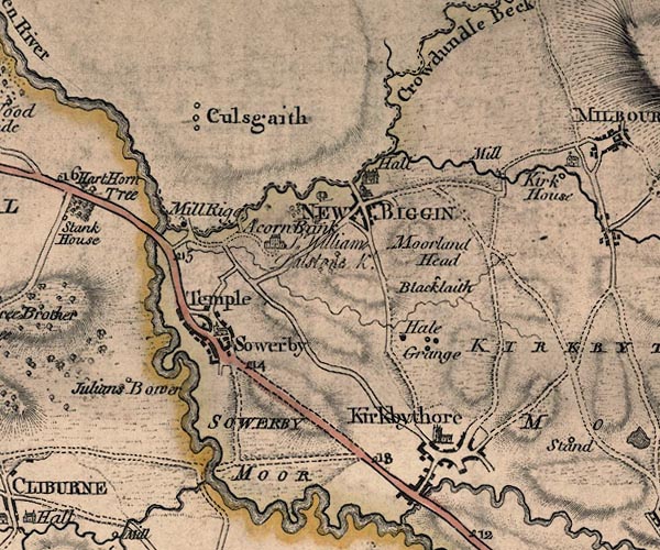 J5NY62NW.jpg double line, road, across a stream; bridge item:- National Library of Scotland : EME.s.47 Image © National Library of Scotland |
|
|
|
||
| evidence:- | old map:- Donald 1774 (Cmd) |
|
| source data:- | Map, hand coloured engraving, 3x2 sheets, The County of Cumberland, scale about 1
inch to 1 mile, by Thomas Donald, engraved and published by Joseph Hodskinson, 29
Arundel Street, Strand, London, 1774.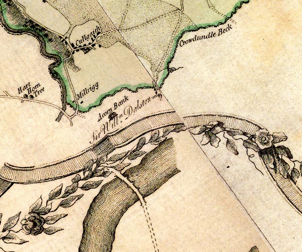 D4NY62NW.jpg double line across a river; a bridge over the Crowdundle Beck at Millrigg item:- Carlisle Library : Map 2 Image © Carlisle Library |
|
|
|
||
| evidence:- | old map:- Bell 1892 placename:- Millrigg Bridge |
|
| source data:- | Map, colour lithograph, Road Map of Cumberland, by George Joseph
Bell, scale about 2.5 miles to 1 inch, printed by Charles
Thurnam and Sons, Carlisle, Cumberland, 1892.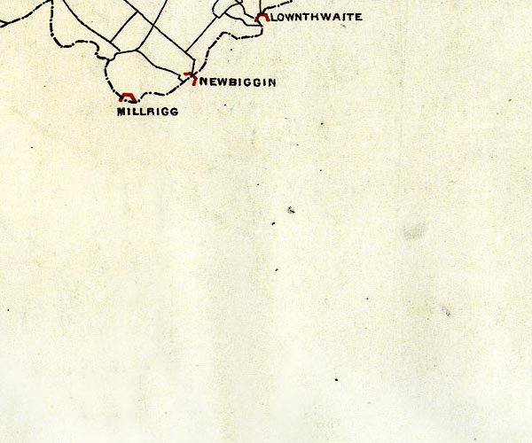 BEL9NY62.jpg "MILLRIGG" bridge symbol; on county boundary Road map of Cumberland showing County Bridges item:- Carlisle Library : Map 38 Image © Carlisle Library |
|
|
|
||
 Lakes Guides menu.