 Old Cumbria Gazetteer
 |
 |
|
| Mosedale Cottage, Shap Rural | ||
| Mosedale Cottage | ||
| locality:- | Mosedale | |
| civil parish:- | Shap Rural (formerly Westmorland) | |
| county:- | Cumbria | |
| locality type:- | buildings | |
| coordinates:- | NY49480949 | |
| 1Km square:- | NY4909 | |
| 10Km square:- | NY40 | |
|
|
||
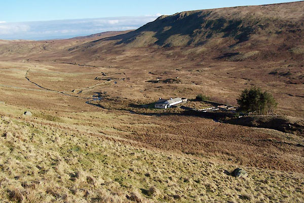 BUA86.jpg (taken 11.2.2011) 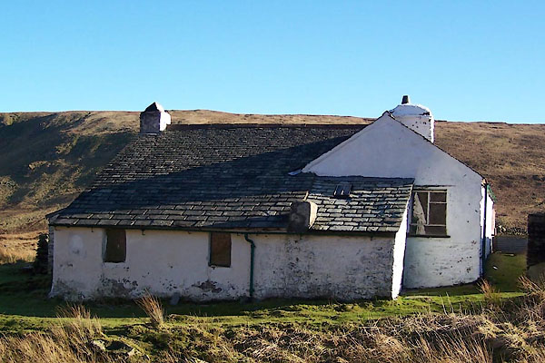 BUA85.jpg (taken 11.2.2011) |
||
|
|
||
| evidence:- | map:- OS Six Inch (1956) placename:- Mosedale Cottage |
|
| source data:- | Map series, various editions with the national grid, scale about
6 inches to 1 mile, published by the Ordnance Survey,
Southampton, Hampshire, scale 1 to 10560 from 1950s to 1960s,
then 1 to 10000 from 1960s to 2000s, superseded by print on
demand from digital data.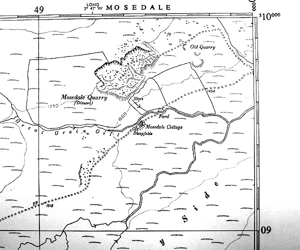 SINY4909.jpg "Mosedale Cottage" |
|
|
|
||
 Click to enlarge BUA84.jpg (taken 11.2.2011) 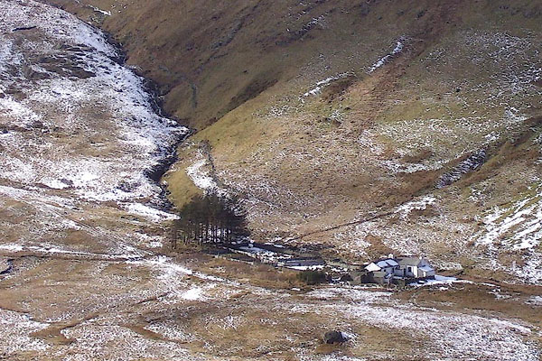 BOT58.jpg (taken 4.3.2008) |
||
|
|
||
 Lakes Guides menu.