 Old Cumbria Gazetteer
 |
 |
|
| Moss Side, Bassenthwaite | ||
| Moss Side | ||
| civil parish:- | Bassenthwaite (formerly Cumberland) | |
| county:- | Cumbria | |
| locality type:- | buildings | |
| coordinates:- | NY22933045 | |
| 1Km square:- | NY2230 | |
| 10Km square:- | NY23 | |
|
|
||
| evidence:- | old map:- OS County Series (Cmd 55 4) placename:- Moss Side |
|
| source data:- | Maps, County Series maps of Great Britain, scales 6 and 25
inches to 1 mile, published by the Ordnance Survey, Southampton,
Hampshire, from about 1863 to 1948. |
|
|
|
||
| evidence:- | old map:- Clarke 1787 map (Bassenthwaite Lake) placename:- Mosside |
|
| source data:- | Map, A Map of Broadwater and its Environs, ie Bassenthwaite
Lake, scale about 6.5 ins to 1 mile, by James Clarke, engraved
by Neele, 352 Strand, published by James Clarke, Penrith,
Cumberland and in London etc, 1787.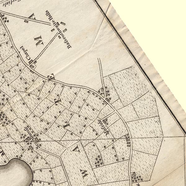 CL8NY23F.jpg "Mosside" item:- private collection : 10.8 Image © see bottom of page |
|
|
|
||
| evidence:- | database:- Listed Buildings 2010 placename:- Moss Side |
|
| source data:- | courtesy of English Heritage "MOSS SIDE AND ADJOINING FORMER BARN / / / BASSENTHWAITE / ALLERDALE / CUMBRIA / II / 72103 / NY2293730454" |
|
|
|
||
 Lakes Guides menu.